H A L R T S A V
High Altitude Long Range Tail Sitter Aerial Vehicle
THE PROJECT
AN INDIGENOUS AIRFRAME AS EFFICIENT AS FIXED WINGS ALSO AS MANOEUVRABLE AS A MULTIROTOR DRONE.

W H A T ?
The Initial Idea was to
Design a DRONE which is - Fusion of a Fixed wing Aircraft as well as a Multirotor Drone.
Drone with high speed - high altitude capabilities of a Fixed wing air craft along with Manoeuvring & Hovering capabilities of a Multi Rotor Drone.
• Fixed wing with take-off and landing in smallest possible space eliminating the Requirement of a Long Runway along Hovering capabilities.

W H Y ?
Market Research, Competitor Products, User's Pain points, Actual On field Scenarios led us to the following Need for the design
INDUSTRIAL APPLICATION
• Compact Packaging needed as Logistics was an issue.
• Smaller the size led to lower coverage area & less battery life.
• Flexibility of Payload requirements & carrying capacity for different applications.
• Complicated to operate & handle the drone.
• Fear of the product as a mistake leads to a serous crash accident.
• Cost effectiveness.
TACTICAL APPLICATION
• Long range coverage required with more flight time & battery life.
• No availability of minimum space for take off & landing.
• Very efficient Aural & Visual Signature for disguise.
• RADAR jump off capability.
• Crash proof design.
• Easy to take-off, Land, Operate & record Flight path.

W H O ?
The DRONE is made for (target audience)
INDUSTRIAL APPLICATION
• Mining, Agriculture, Land Survey, Highways & Pipeline Inspection, Land Slide.
• A Civilian application where long range area coverage is required for 3D imaging & mapping of the geography & its inspection.
TACTICAL APPLICATION
• Armed Forces with special requirement of Surveillance applications & Challengeable field requirements .
• Tactical Application includes going deep into the Enemy territory with low Aural & Visual Signature, Capturing detailed pictures of the territory, 3D imaging & mapping of the geography without getting detected into RADAR & Back. Sometimes the Terrains does not provide the Privilege of a long Runway for Take- off & Landing.


W H E N ?
The PROJECT took a total time of 25 weeks.
Including on field User research For -
INDUSTRIAL APPLICATION
• In Mumbai - Pune Western Ghats, INDIA for Land slide survey for duration of 1 week.
• In Punjab, INDIA for Agricultural survey for duration of 1 week.
TACTICAL APPLICATION
• In base camp of INDIAN ARMY Northern Commands in Terrorism affected area Kashmir, INDIA for duration of
1 week.
• In base camp of CENTRAL RESERVE POLICE FORCE in Naxalite affected area Chhattisgarh, INDIA for duration of
1 week.
USER RESEARCH
Mumbai - Pune Western Ghats, INDIA.
• Long Hilly area for Kilometers, Monsoon Climate, Irresistible Land slide prone areas chocking the highway and Life threat.
• Inspection of Accidents & traffic needed daily basis.
Punjab, INDIA.
• Long Agricultural Land, daily inspection needed with multispectral camera over the Crops.
• Agricultural needs & worker inspection on daily basis.
• Dusting of Pesticides.
• Inspection for wild fire & wild animals in the field.
INDIAN ARMY Northern Commands Kashmir, INDIA.
Patrolling.
Keep Guard on post.
Assistance for Live action party during Operation.
Hostage Situations.
Border Security over Line Of Control.
Militant Infiltration.
Mob Control (Stone Pelting & Fire Burst).
Highway & Road Surveillance.
Surveillance around military activity.
Own Military Base Research.
Intel About terrains for Operations.
Gather Intel before Operation Plan.
Rescue during Natural calamities.
Dive deep into the enemy territory for intel.
Special Case, They have to go through Surprises during Mission-
-Can be Surprise attack.
-Can be Land Mine / Planted Explosives.
-Can be a Situation of Quick Hiding (EVAC & HIDE).
CENTRAL RESERVE POLICE FORCE Chhattisgarh, INDIA.
They use UAV for everything, basically as a SAFETY SURVALLIANCE DEVICE.
For any kind of mission/ commutation In the area around, UAV is sent for surveillance-
–Checking for any Human Entity
–Checking for any Possible Land mine or Explosives (by Zoom & observation of Soil / Ground)
–Checking for any camp / base / building / Suspicious Object is carried out.
–Unavailability of UAV makes most of their Operations SLOW & TWICE RISKY.
H O W ?
Mind Mapping

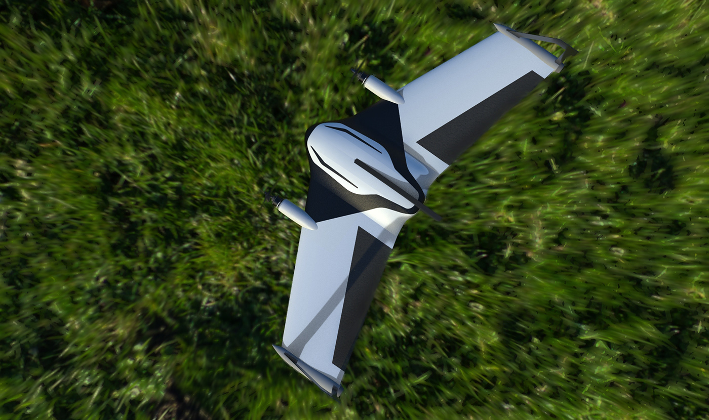
New working Principle VTOL-
VTOL aircraft can take off and land with zero velocity and hover in the air like a helicopter, and fly at high speed horizontally like fixed-wing aircraft. The tail sitter UAV is a kind of superior performance VTOL aircraft due to its flexible handling and does not require complex thrust reversing mechanism.
Proof of Concept
Initial Ideation & Sketches


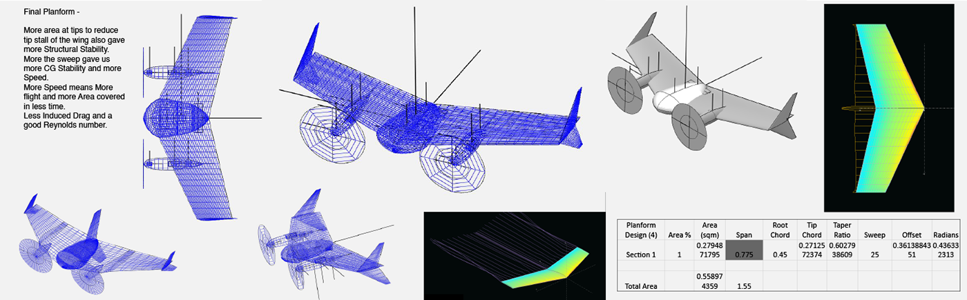
Wireframe and Aerodynamic Analysis


IMPORTANT DESIGN DETAILS


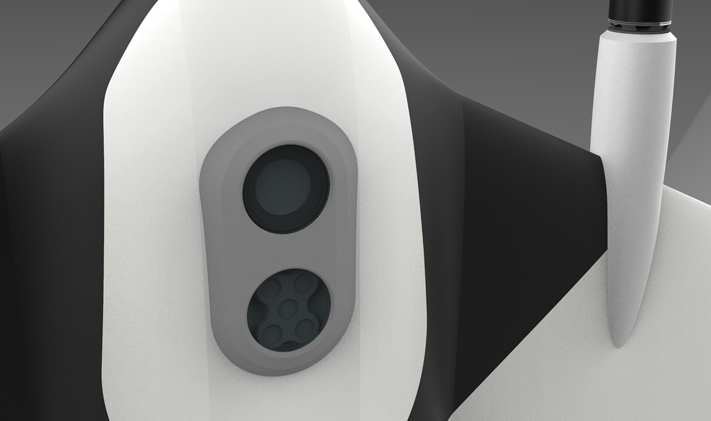
Payloads according to Shutter Speed 1 per Second and 1 per 2.8 Seconds were Selected - Sony alpha NEX-5 , Micasense RedEdge.
Selection of Usual Mission Profile of the UAV According to Expected Users and Estimation of battery, Flight time, flight Speed, Payload Selection
Estimation of Max Take Off Weight
Empty Weight (empirical and experience) 1500+ Payload (Nex5,7, A6000, QX1) 700+ Battery (based on Weight required) 1000= 3200 gm.
Battery weight estimation = 1000 gm.
Battery Current Drawn Cruise speed per minute -Cruise (Watts) 80.09.
Total Energy Required (Watts) 156.1235653.
Cruise CL required 0.3227028393.
According to Effect of Aspect Ratio on Cruise performance, Stall speed and Wingspan Length best selected Aspect Ratio is 4.5
- Not too high not too low.
Wing Wetted Area (sqm) 0.895019994
Fuselage Wetted Area (sqm) 0.254908021
Pod Wetted Area (sqm) 0.080586563
Density 1.17 according to height it is going to fly.
Dynamic Viscosity 0.000016
COMPONENTS & OTHER ASPECTS


Product variant for ARMY INFANTRY.

Product variant for MARINES, AIR FORCE, PARA MIL SPECIAL FORCES.


Product variant for HOME SECURITY & POLICE, CENTRAL RESERVE POLICE FORCE.


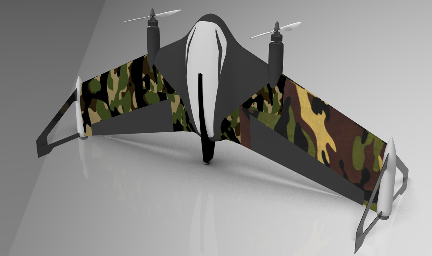
A VIEW FROM THE BOTTOM

T H A N K Y O U F O R W A T C H I N G
H A L R T S A V
BY CHINMAY RAUT
For More Visit at
https://vrisan.co/
https://vrisan.co/