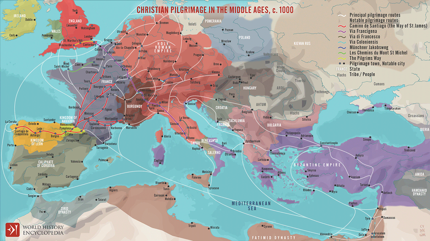
A map illustrating the changing patterns of Christian pilgrimage during the Middle Ages - for the average European, a pilgrimage to Jerusalem was out of the question - a journey to the Holy Land was too far, dangerous, and forbiddingly expensive. It became common for Christians who sought to close the distance between themselves and God to make a pilgrimage closer to home, visiting more local sites associated with saints, martyrs, and holy relics.
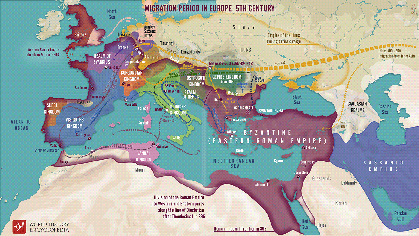
A map illustrating migrations of various peoples across fractured Europe and Western Asia after the division of the Roman Empire at the end of the 4th Century
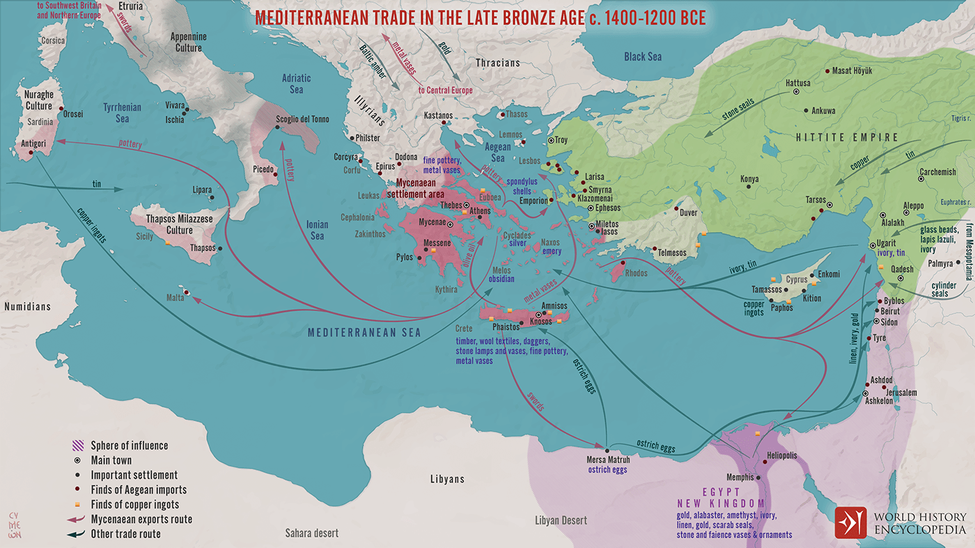
A map illustrating the late Bronze Age trade in the eastern Mediterranean seaboard as a region of increasing connectivity between the key players Pharaonic Egypt in the south, the Hittite Empire, Mesopotamia, and the Levant to the east, and the Mycenaean Civilization to the west.

A map illustrating the expansion of the Phoenicians, including the trade routes and process of Phoenician colonization, from its origins in the Levant region of the eastern Mediterranean, until its height when it spanned from Cyprus to the Iberian Peninsula and beyond.
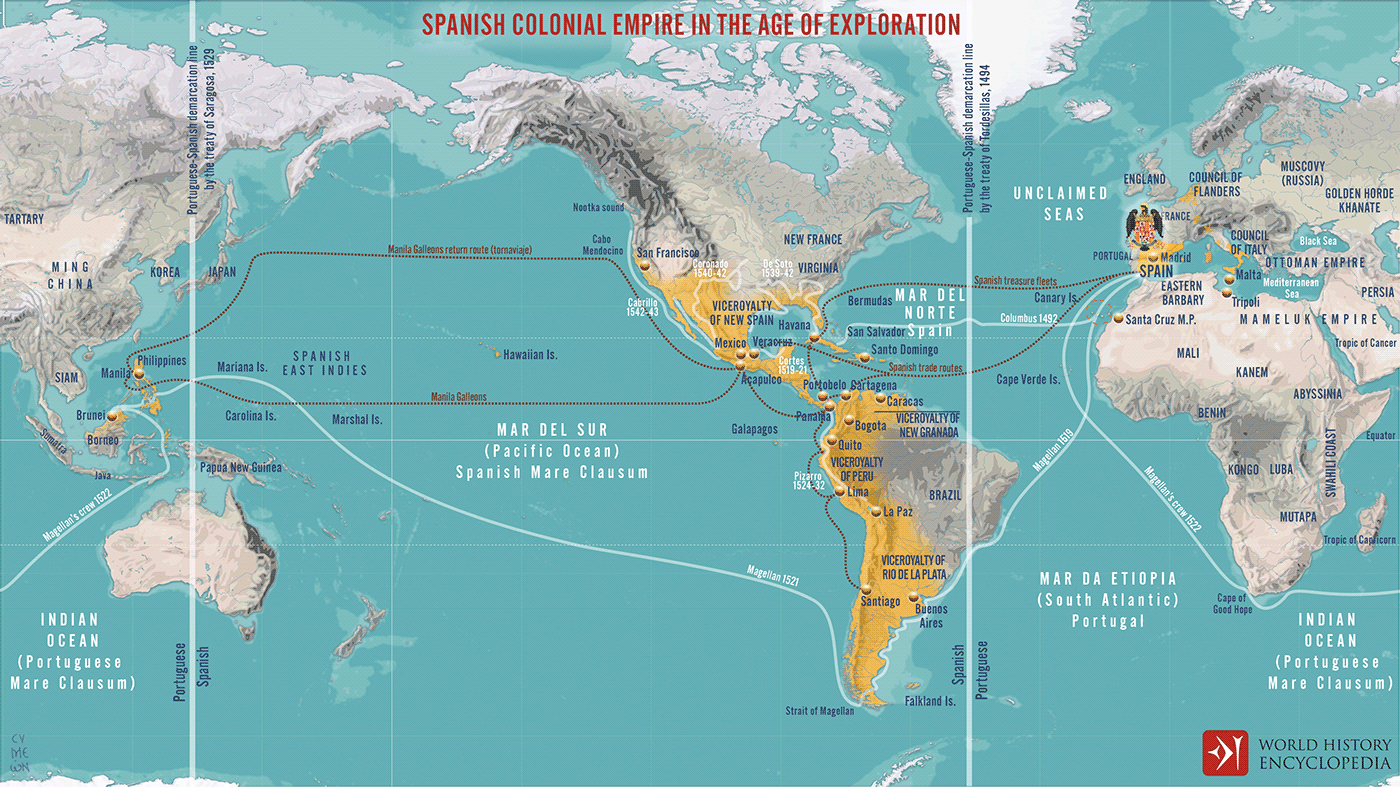
A map illustrating the rise of Spain into a global colonial and trading power following the European Age of Exploration of the 15th Century.
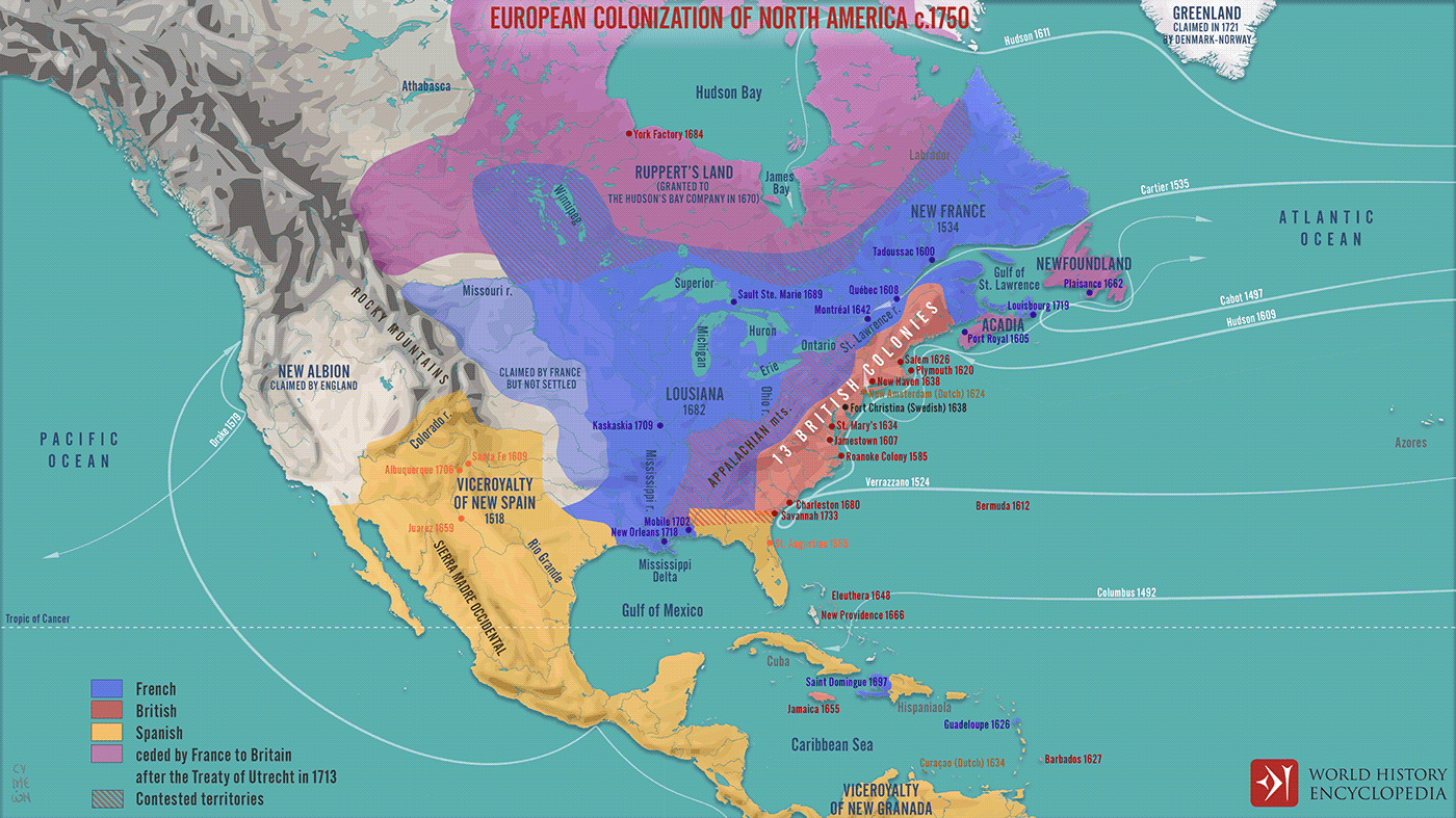
A map illustrating the process of systematic European colonization of North America during the Age of Exploration - from the 1490s until the start of the French and Indian War of 1750s. It also depicts the shift of balance of power in the region following the treaty of Utrecht of 1713.
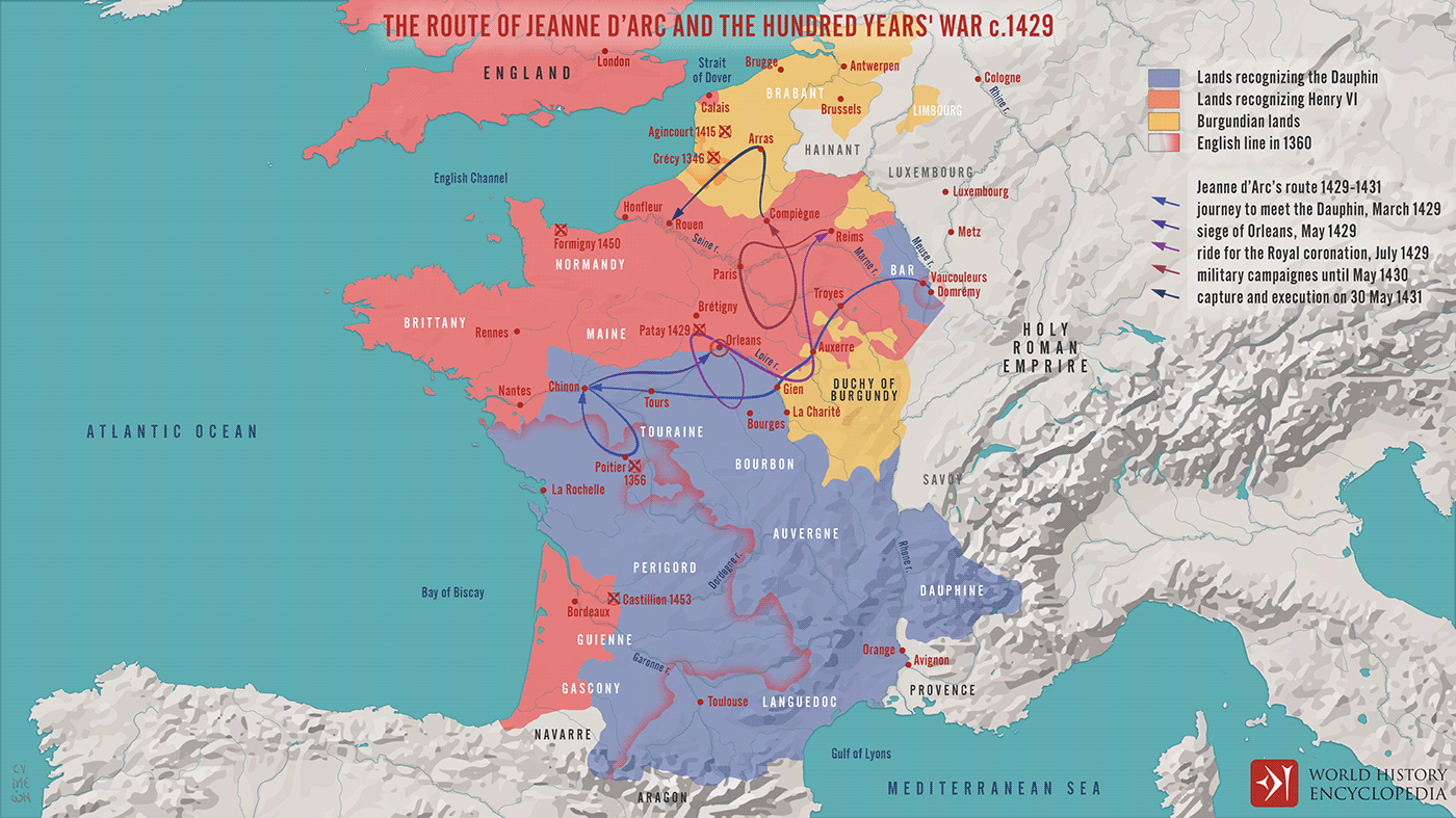
A map depicting the state of the Hundred Years' War around 1429 and illustrating the impact of Joan of Arc (Jeanne d’Arc) on the course of events from her journey to meet the future French king, Charles VII, through her participation at the Siege of Orleans and the Royal Consecration in Reims, until her capture and execution on 30 May 1431

