

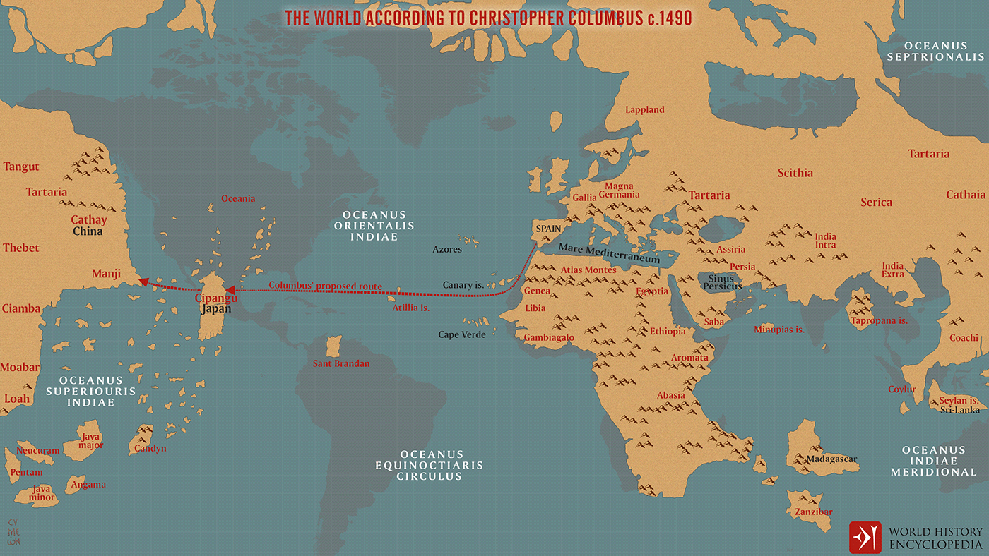
A map created for World History Encyclopedia illustrating Christopher Columbus’s image of the world before his first voyage in 1492. It was based on a map by Toscanelli, depicting the planet about 25% smaller than it actually was, and ignored the (correct) measurements of Eratosthenes from some 1700 years earlier, compounded by his own wishful thinking and wrong mathematical assumptions. By Columbus' estimate, Asia was about 2,500 miles west of Spain. He was mistaken by roughly 8,000 miles.
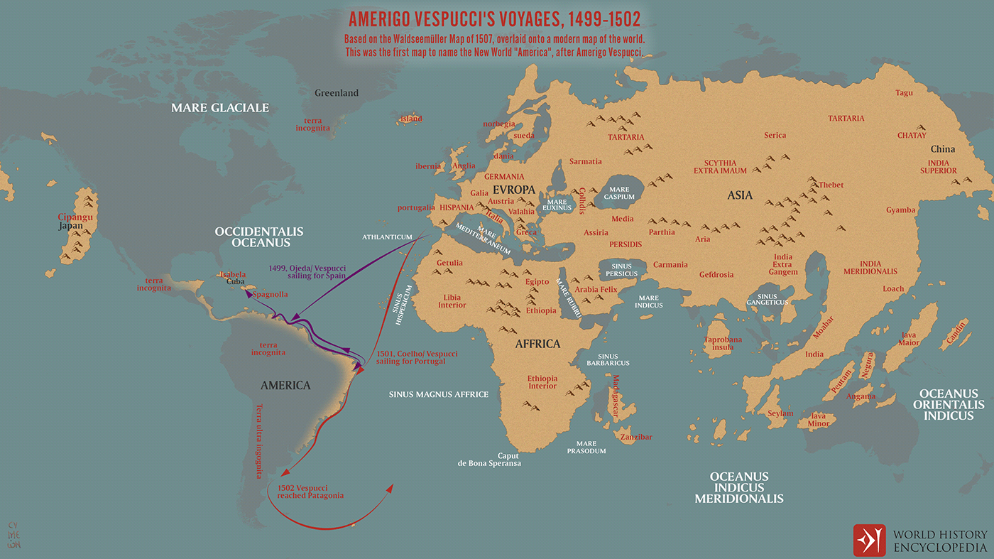
A map created for World History Encyclopedia depicting the two transatlantic voyages of Amerigo Vespucci between 1499 and 1502.
It is based on the 1507 map by Martin Waldseemüller, a German clergyman and cartographer, which first referred to the southern hemisphere where Amerigo Vespucci landed in 1501 as America. Waldseemüller and his collaborator Matthias Ringmann gave their Introduction to Cosmography an accompanying world map and a printed globe and so were the first to position America as a continent separated from Asia by an unknown ocean.