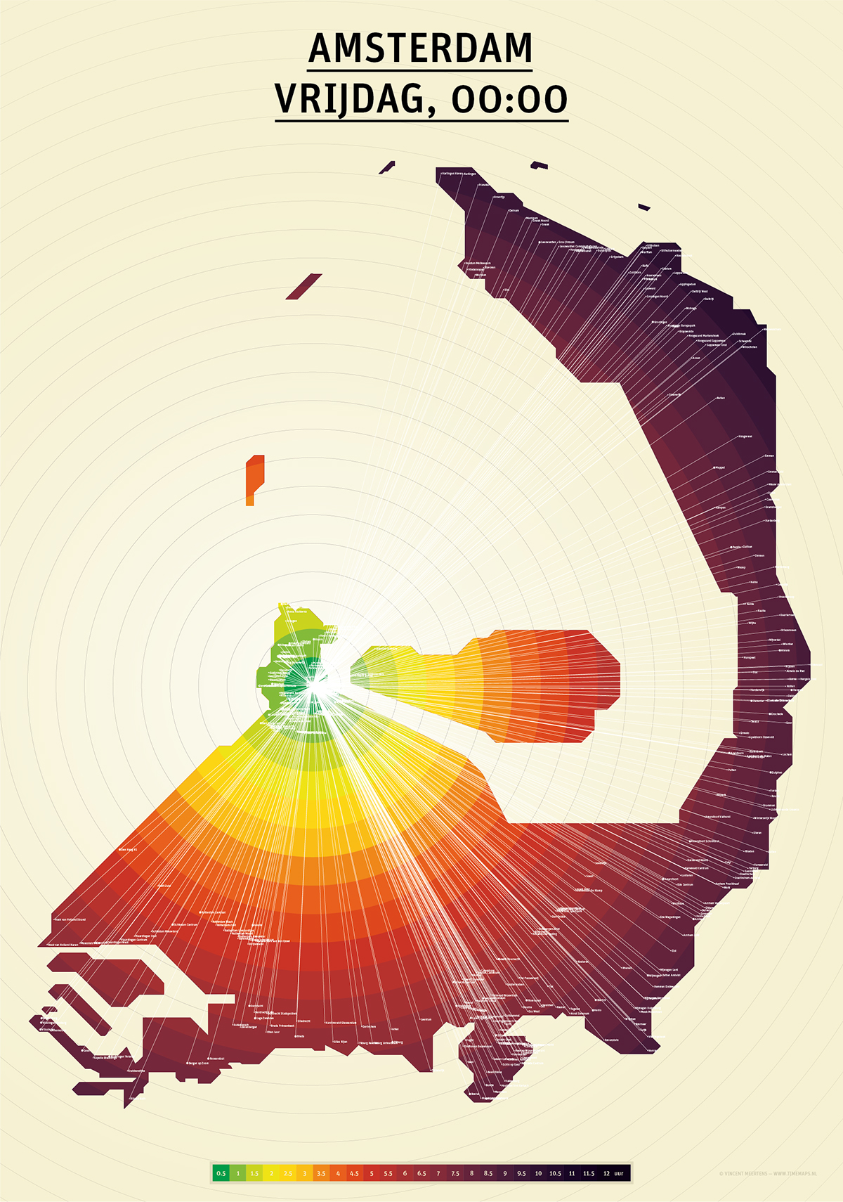
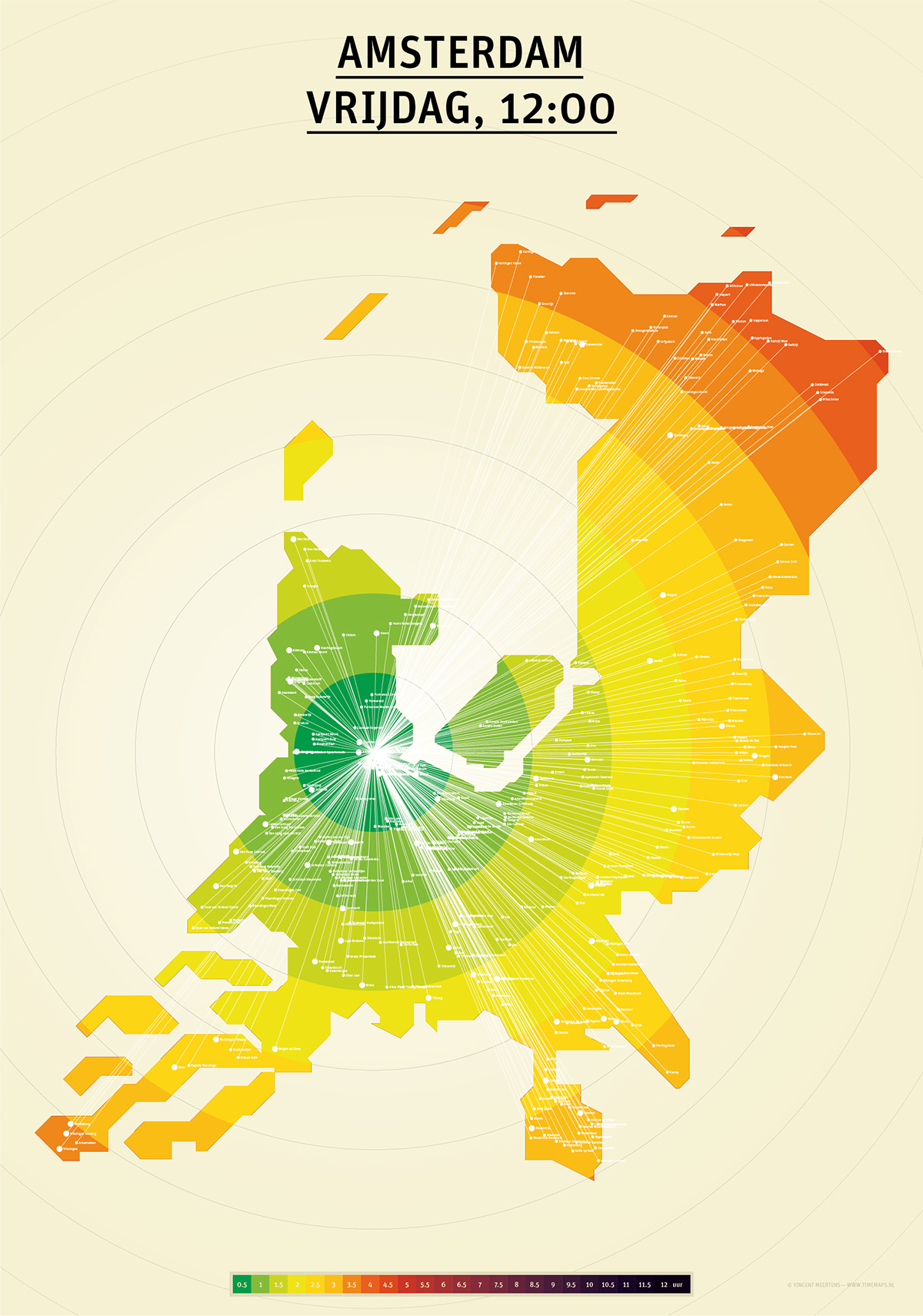
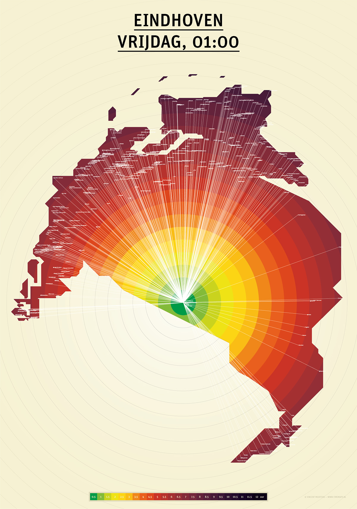
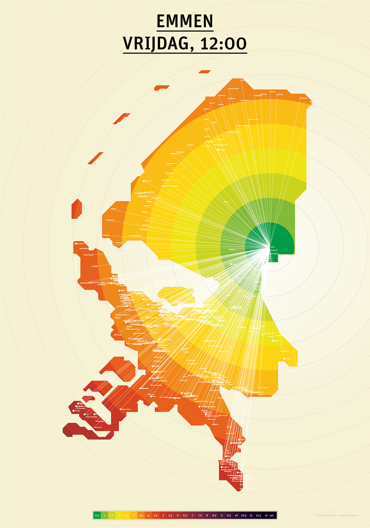
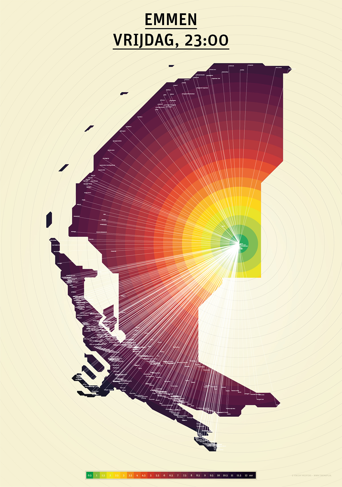
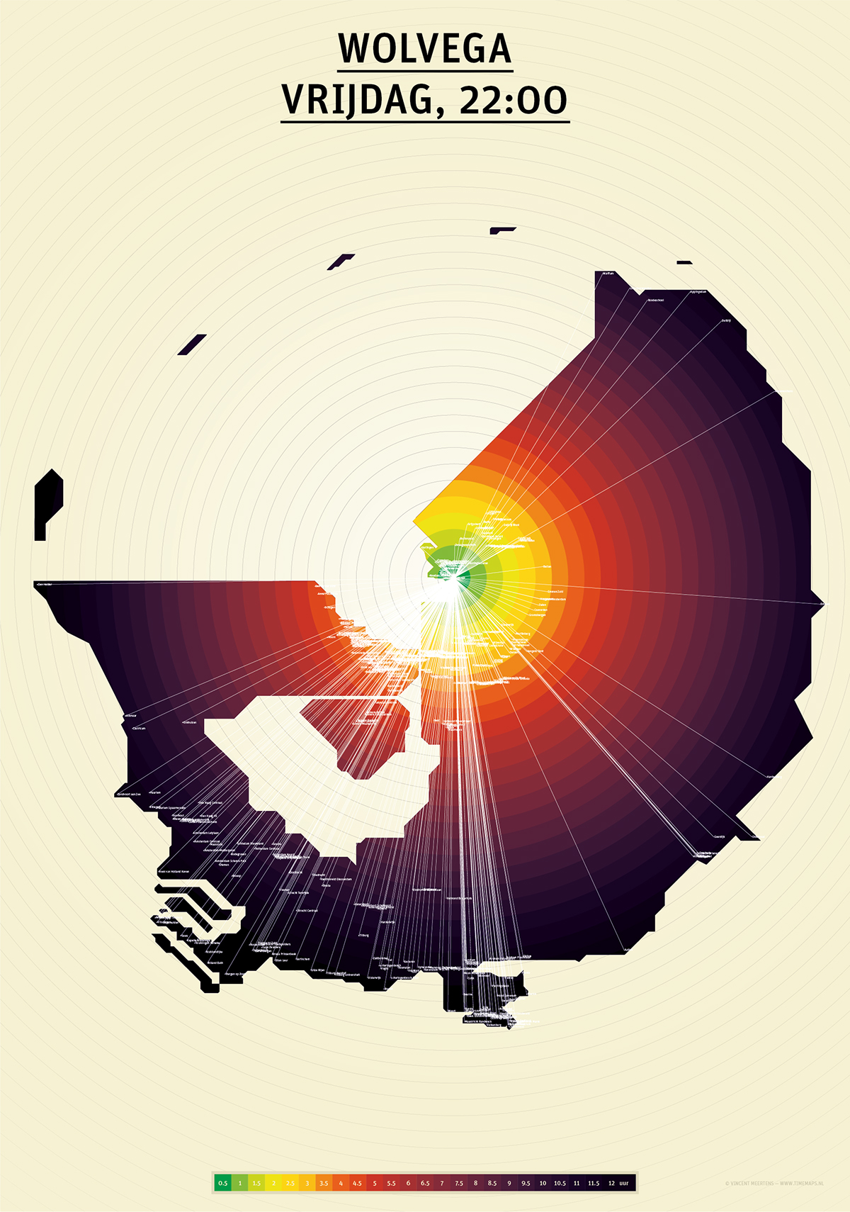
Due to the good public transportation in the Netherlands distance has become irrelevant. We can reach almost any destination by train easily and relatively quick. In our busy lives we now think in time rather than distance. Therefore the current maps, as we know them today, are obsolete. Thinking in time affects a map and hence the shape of the Netherlands also depending on the perspective from which we look. From the perspective of Eindhoven, for instance, the Netherlands is relatively small because of the quick and easy connections to other cities. At the same time, seen from a more remote and small village such as Stavoren the Netherlands is much bigger. Not only the location from which one looks, or travels, but the hour of the day is very important.
At night the map of the Netherlands will expand because there are no night trains and in the morning it will shrink once trains will commence their schedules. The map of the Netherlands will never be the same again.
Explore TimeMaps live at http://app.timemaps.nl
(works best in the newest versions of FireFox or Google Chrome)
More information here: http://www.timemaps.nl
All TimeMaps posters are for sale at http://www.timemaps.nl/shop/


