Eight ways to generate city maps and analyze urban behaviors, through the use of the inhabitants perception and temporal data.
It is difficult to “picture” knowledge if it indeed lacks formas this conception suggests. Yet a simple cartographic illustration of how knowledge exists without specific form should clarify the situation. You may know where certain places are, or how certain areas are arranged, even though we have not actually seen them and have only derived such knowledge from maps. Yet if we were asked to describe the graphic characteristics of the maps from which we derived the knowledge, it is unlikely that we would be able to recall line weights, type styles or colors. Yet we know the relations that were depicted, regardless of the form of the original marks. Once we assimilated those marks and converted them into tacit knowledge, they lost their form. However, we can retain the relations of interest to us, that is, the structures of the maps from which they were obtained.
Barbara Petchenik,Cognition in Cartography, Newberry Library
The meaning of maps is a consequential spatial arrangement; it is the fact that objects isolated in real perceptual experience are not important. Cartographers are not concerned with the nature of objects per se, but rather with a particular set of relationships between those objects. The reader must reconstruct these relationships in his mind for the map to have meaning.
TEST #03
Bertrand Russell puts it this way: "The first thing to notice is that different senses have different spaces.
The space of sight is quite different from the space of touch; it is only by experience in infancy that we learn to correlate them. The one space into which both kinds of sensations fit is an intellectual construction,
not a datum."
After reading these words I started researching how to mix the cartographic maps I had previously created with this new way of seeing space. How is it possible to isolate the different spaces of senses in a graphic way?

TEST #04
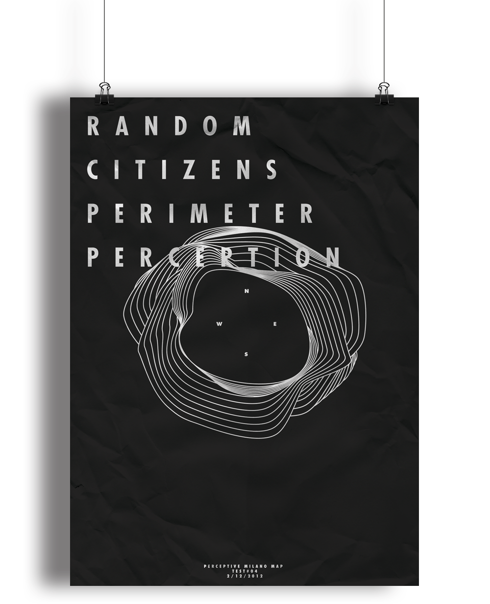
In order to understand how people perceive the city, one of our exercises was to ask different people to draw their perception of Milan as a basic shape in a book. After looking at all these shapes I wanted to create a map that could cover all of them, to find a mother shape that could describe the collective visual perception of the city.
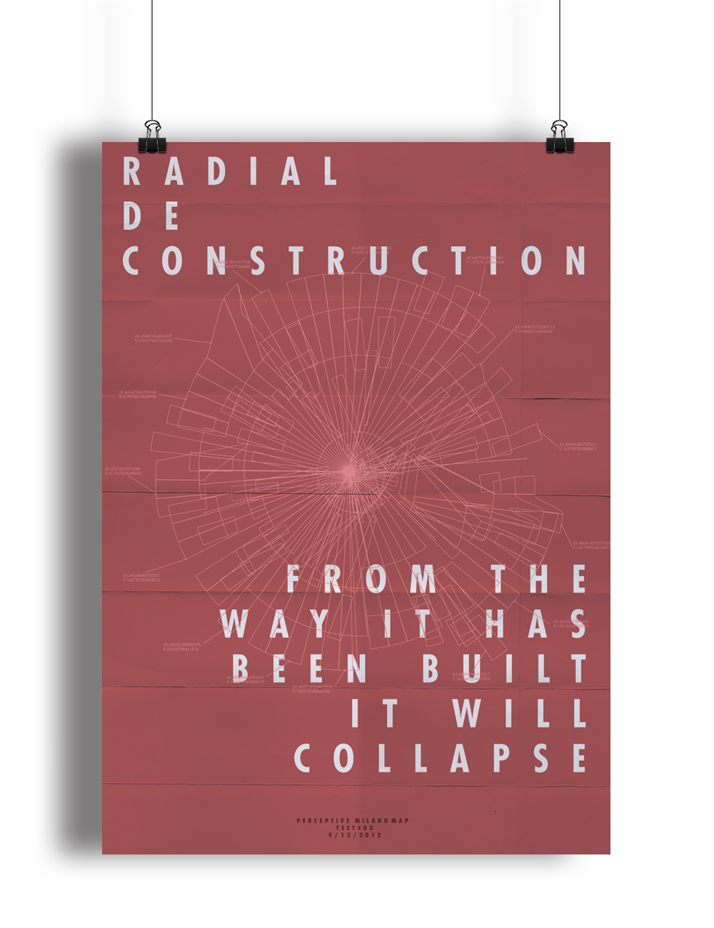
The expansion of monocentric cities, such as Milan, in ever-growing radial rings, is thought of and described mainly as a centrifugal process. It brings a radial shape to the maps.
The external boundaries of the city, suddenly made unrecognisable, are the object and the main issue in the debate on the city’s expansion. To describe the nature of this phenomenon, the phrase “endless city” has been coined. Using destruction as a constructive agent here, we can see how the rings can bring a whole new geography to the city.
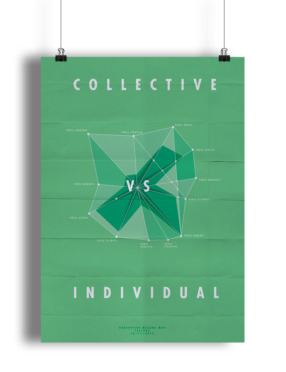
A comment made by Bertrand Russell made me think: “Scientific knowledge aims at being wholly impersonal and tries to state what has been discovered by the collective intellect of mankind. It is important for cartographers to understand this distinction between individual and collective intellect.”
This time the challenge was to destroy this old division between individual and collective intellect. I want to generate a map created by the perception of a collective but also mix it with my own subjective point of view.
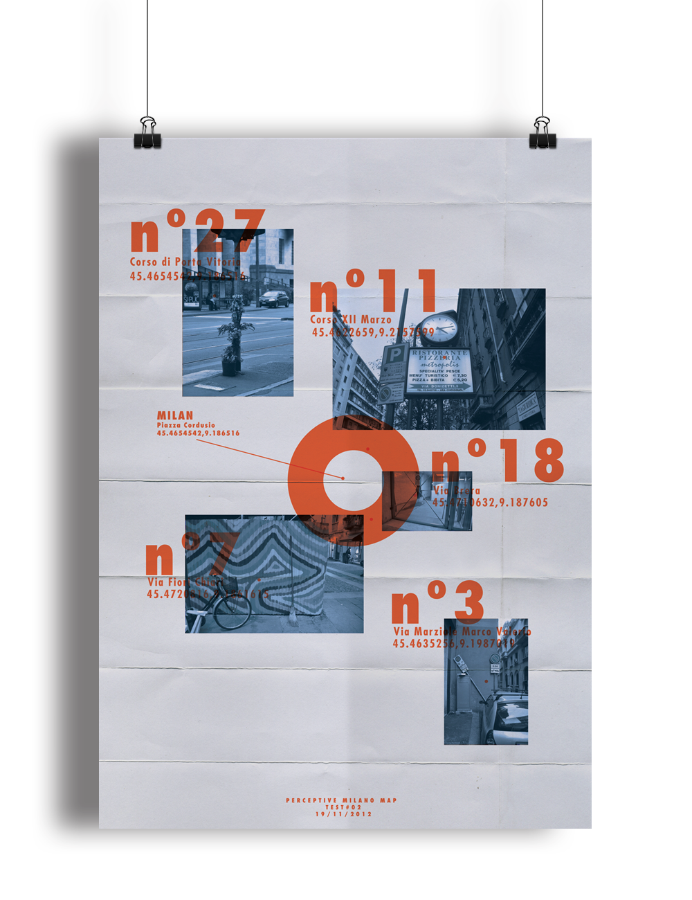
First I generate my own perceptive map. One thing that catches my attention in Milan is that at every corner these is a gate. I want to make a personal map of those gates and mix this with the collective information. In order to construct a first collective perception of these places I use digital tools such as Google
Adwords, Gephi, Cytoscape and start analysing physical places as if they were virtual places, based on the number of likes, searches and virtual visitors.
For a good many years, researchers in the field of reading and linguistics approached the problem of the acquisition of knowledge from printed symbols from the idea that meaning was assembled on a unit-by-unit basis in linear sequence. One began with small units, such as letters and words, and then built up to the larger units of sentences and paragraphs.
But while this view has been essentially discarded, no replacement has yet been completely worked out. A new view sees the eye-brain interaction as not necessarily linear, but rather complex, utilising processes that allow the apprehension of the visual stimuli of printed text at several levels simultaneously. Meaning seems to come from an all-at-once grasp of the relationship of the stimulus to the reader’s previous knowledge structures, rather than from a bit-by-bit build up. We have all had the experience of glancing at a paragraph or page in order to quickly derive meaning, with no recollection whatsoever of individual letters, words or sentences. Meaning goes beyond particular forms.

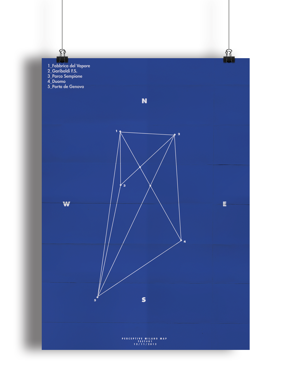
In this map I wanted to explore the concept of non-places. Normally we orient ourselves first of all by locating ourselves on a map, then the map makes sense. It’s all about where you are. But what if we change that point, what if your first reference is always a place where you are not, what if you locate yourself using the distance between this place and you?

This project is part of the Common Ground duo-exhibition
hosted in Fabbrica del Vapore in Milan on Jan-Feb 2013
in collaboration with the artist Klaus Fruchtnis.
Follow new projects on: