Although water may have different connotations depending on its context, in a Latin American city it is essential to understand it as piece of infrastructure and how it relates to the other elements of the urban fabric, in order to reverse the conditions of residual public spaces or urban voids and transform them into nodes or main axes at different scales of the city.
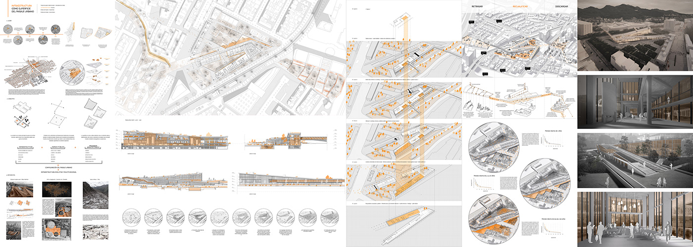
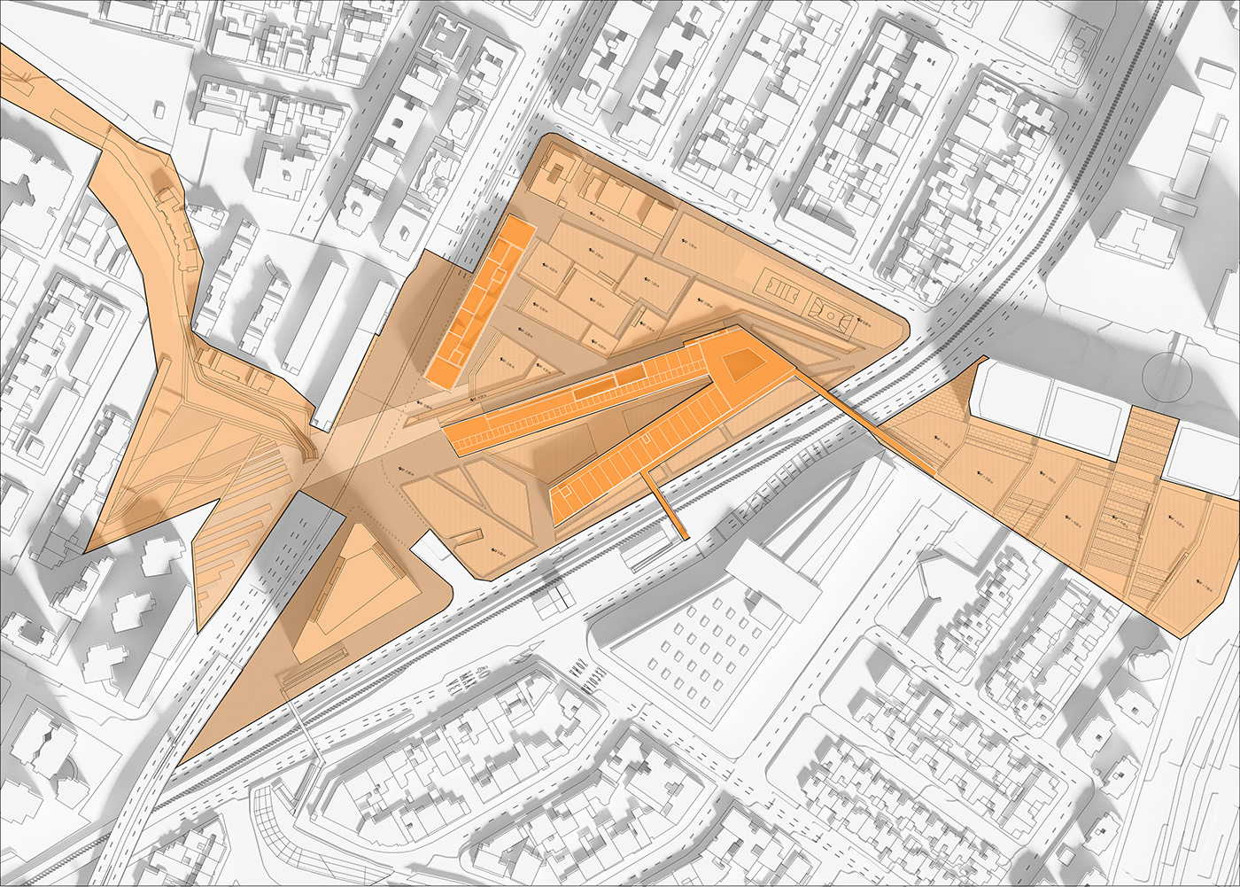
Having this in mind it is decided to work on the neighborhood of “Molinos norte” in north Bogotá, in the lot of the aqueduct where the pumping plant and the electric substation are located. Adding to these the train railroads and the “molinos” river, there is a collision of different urban infrastructures, resulting in housing with low quality of habitability, restricted pedestrian accessibility and inopportune closures for the urban connectivity of the quadrant. This specific conditions result in an immense potential for an urban and architectural project, whose main objective is to reorganize and reconnect these elements, through topography and surface reprogramming, to help create a more sustainable and efficient city, where infrastructure is no longer thought only from traditional engineering, but must be integrated together with the public space and the architectural program, to make this into an evolutive and multifunctional infrastructure.

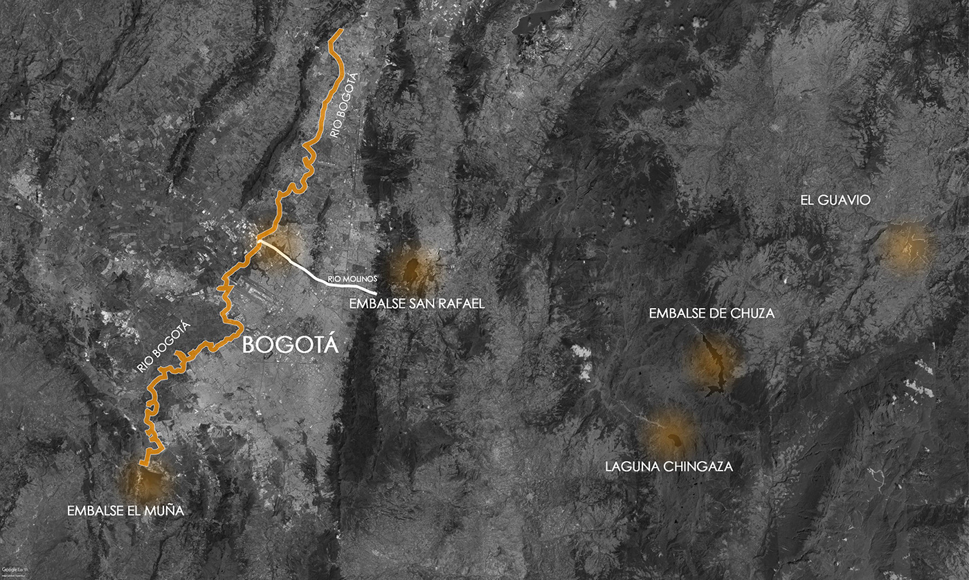
Cuerpos hídricos indispensables para el abastecimiento de agua y electricidad en el área metropolitana y regional de la ciudad de Bogotá.
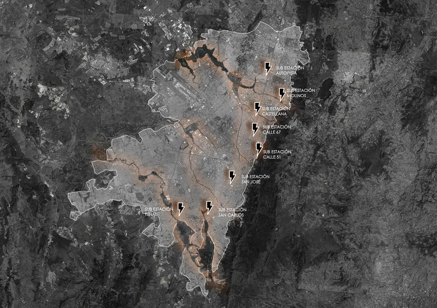
Ejemplo de infraestructura urbana al oriente de Bogotá, Subestaciones eléctricas le dan la espalda a la ciudad con cerramientos agresivos y alta radiación. Algunas de estas infraestructuras se conectan directamente con la estructura ecológica principal de le ciudad, entre estas está la Sub estación eléctrica y la planta de bombeo del acueducto en el sector de Molinos norte.

Objetivo general: Integrar los elementos de infraestructura tradicional de la ciudad, junto con el espacio público y el programa arquitectónico, dando como resultado una infraestructura evolutiva y multifuncional que configure un nuevo paisaje urbano.

Estado actual del sector

Estado actual del sector
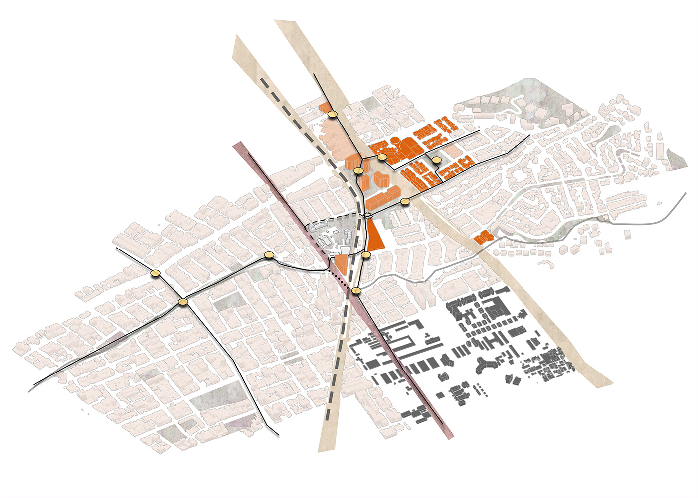
Usos , vias , nodos y flujos peatonales
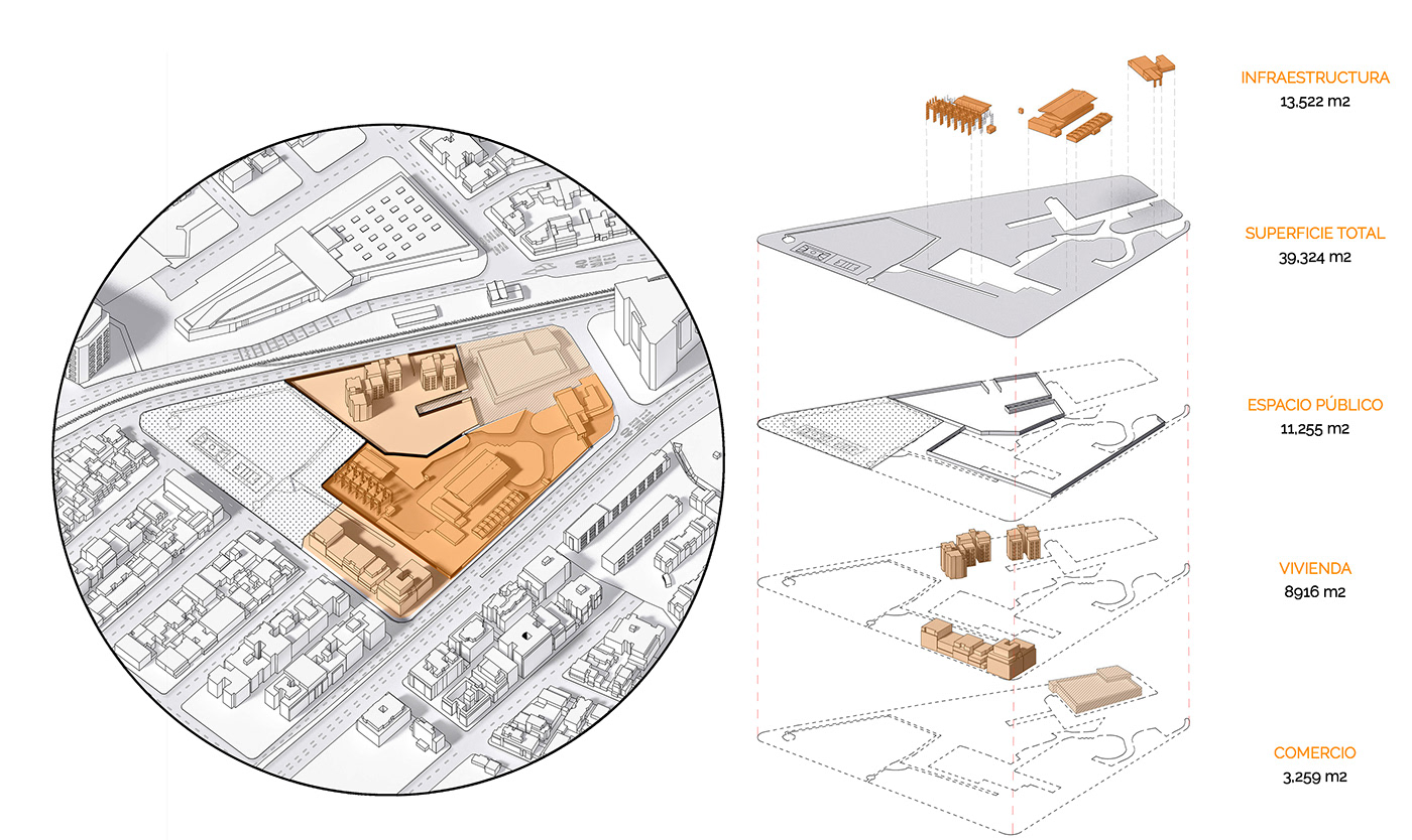
Despiece de la manzana con el lote del acueducto


Planta primer nivel n-3.00 m esc 1:500
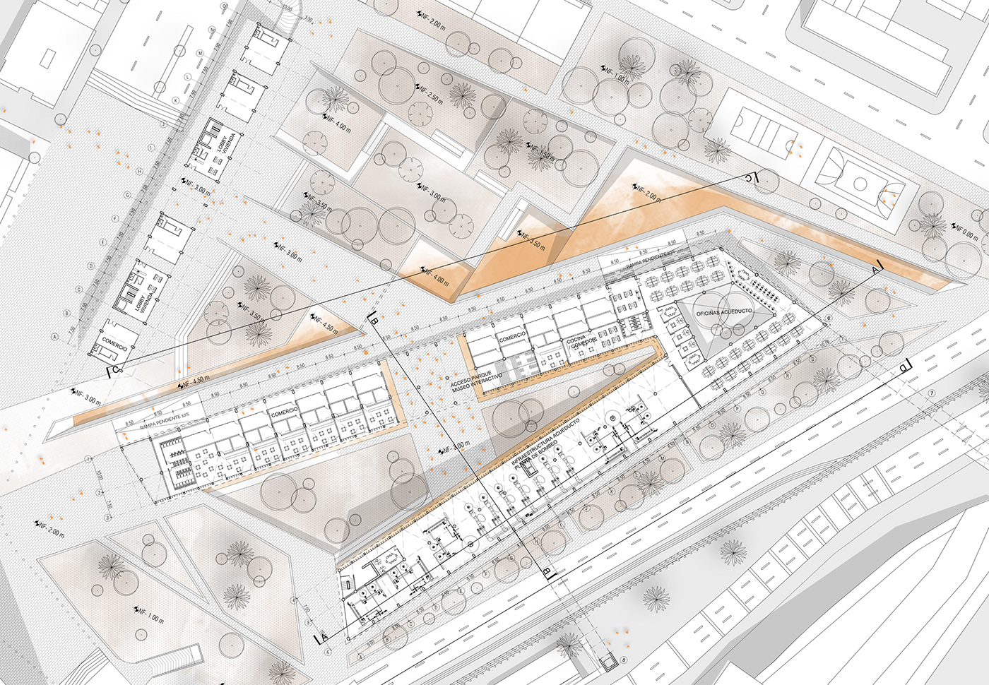
Planta primer nivel n-3.00 m esc 1:250

Corte A esc 1:250
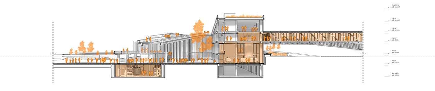
Corte B esc 1:250

Corte C esc 1:250
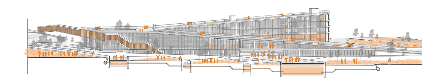
Corte D esc 1:250

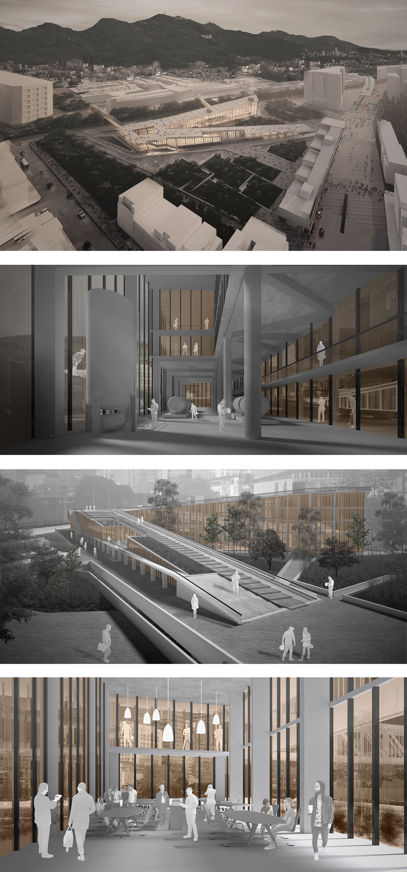
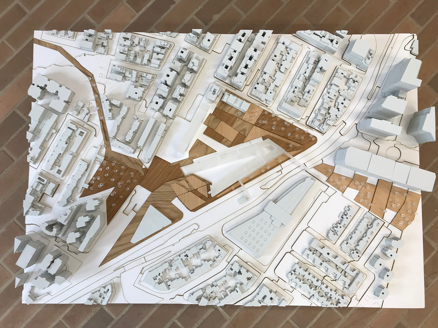
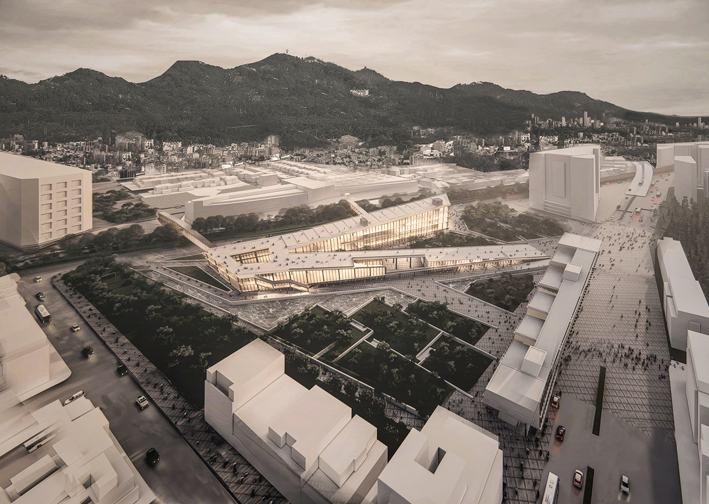
Maqueta esc 1:750
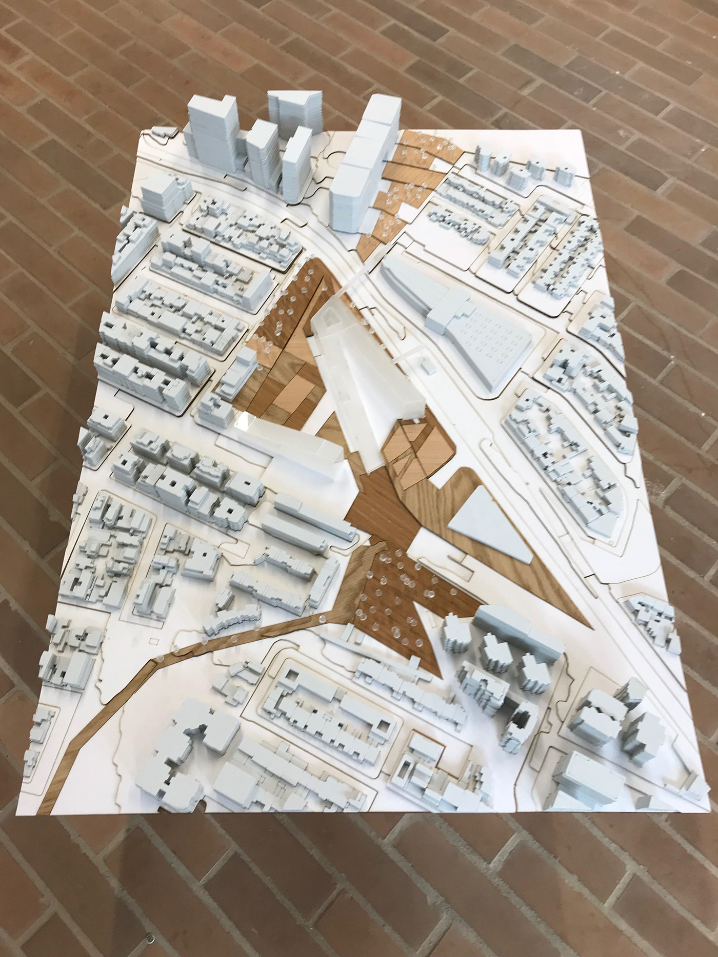
Maqueta esc 1:750

Maqueta esc 1:750

Exposición entrega final Unidad Avanzada

