
A E R I A L V I E W F A C I N G N O R T H
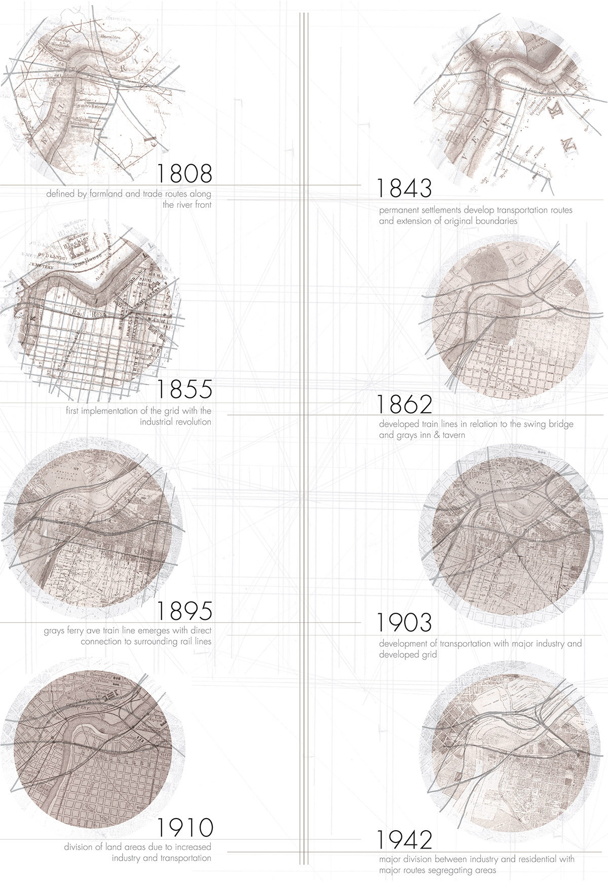
A N A L Y S I S O F H I S T O R I C A L M A P S I N R E L A T I O N T O I N D U S T R I A L G R O W T H & S P R A W L
The findings of this analysis concluded that the area developed originally at a similar rate as the rest of the city- utilizing the proposal of the original city grid. However, as industry moved in along the river, housing was pushed inward- tennant housing was produced and the water-line was crowded with factories and business. As the industrial revolution came to an end, the area was left with many abandoned structures and a disconnected neighborhood composition.
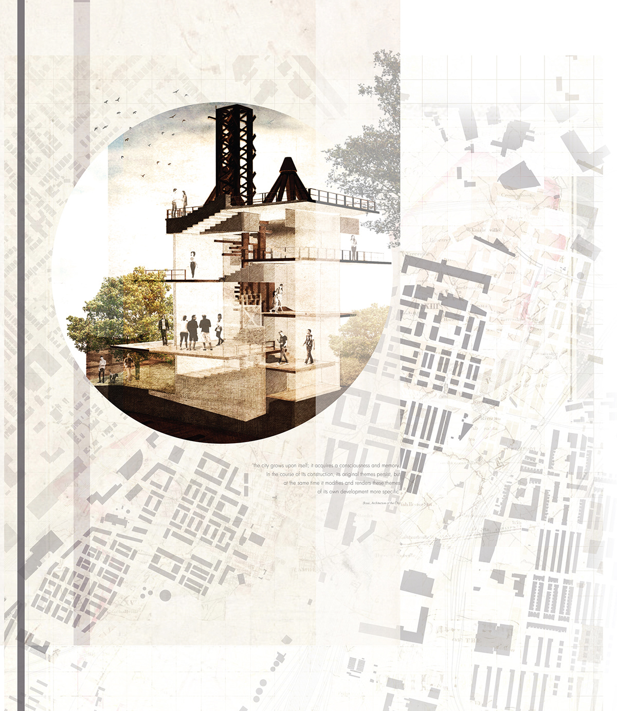
"THE CITY GROWS UPON ITSELF; IT ACQUIRES A CONSCIOUSNESS AND MEMORY. IN THE COURSE OF ITS CONSTRUCTION, ITS ORIGINAL THEMES PERSIST, BUT AT THE SAME TIME IT MODIFIES AND RENDERS THESE THEMES OF ITS OWN DEVELOPMENT MORE SPECIFIC"
-ROSSI, ARCHITECTURE OF THE CITY-
This sketch portrays an abandoned train hoist that sits along Grays Ferry Ave. This train hoist is visible at almost every point in the neighborhood, i95, surrounding bridges and high-points. Analyzing the structure, imagining the dynamic that existed throughout the site's life and the life it could encompass is showcased in this vignette. This structure is important to the fabric of the neighborhood and serves as a beacon of hope.
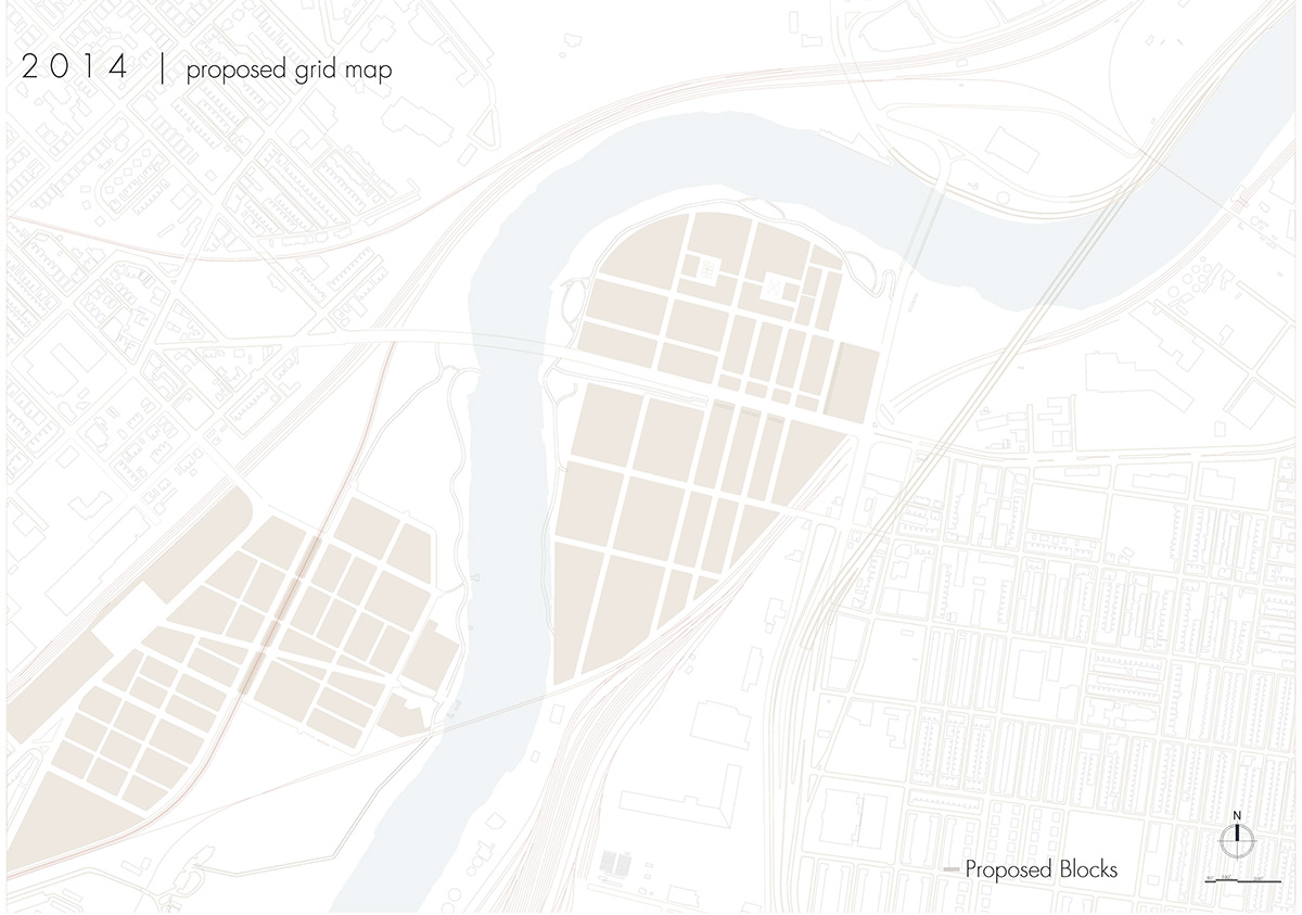
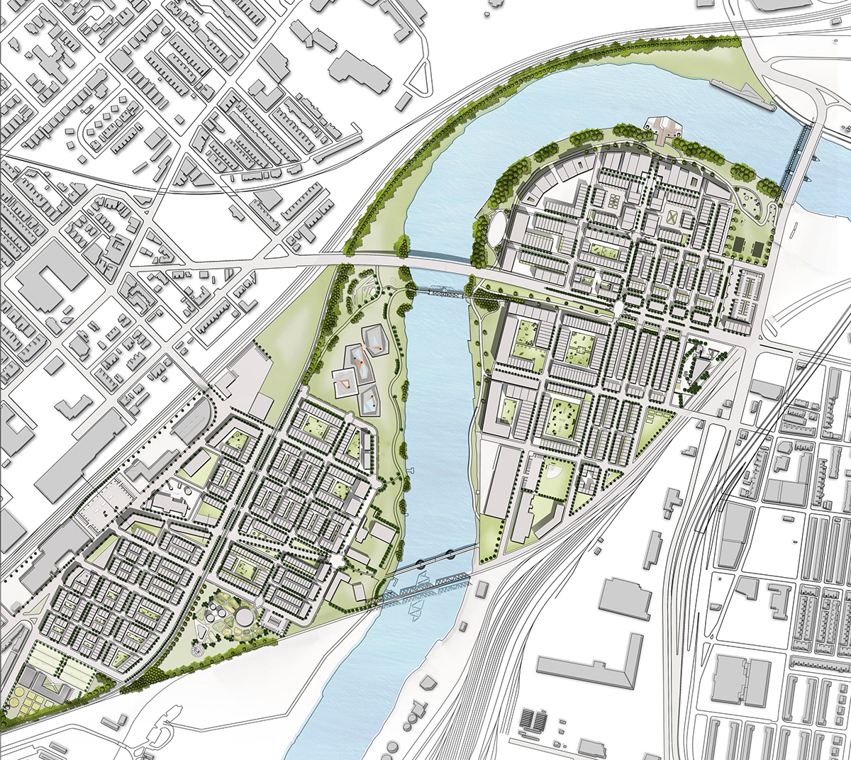
M A S T E R P L A N
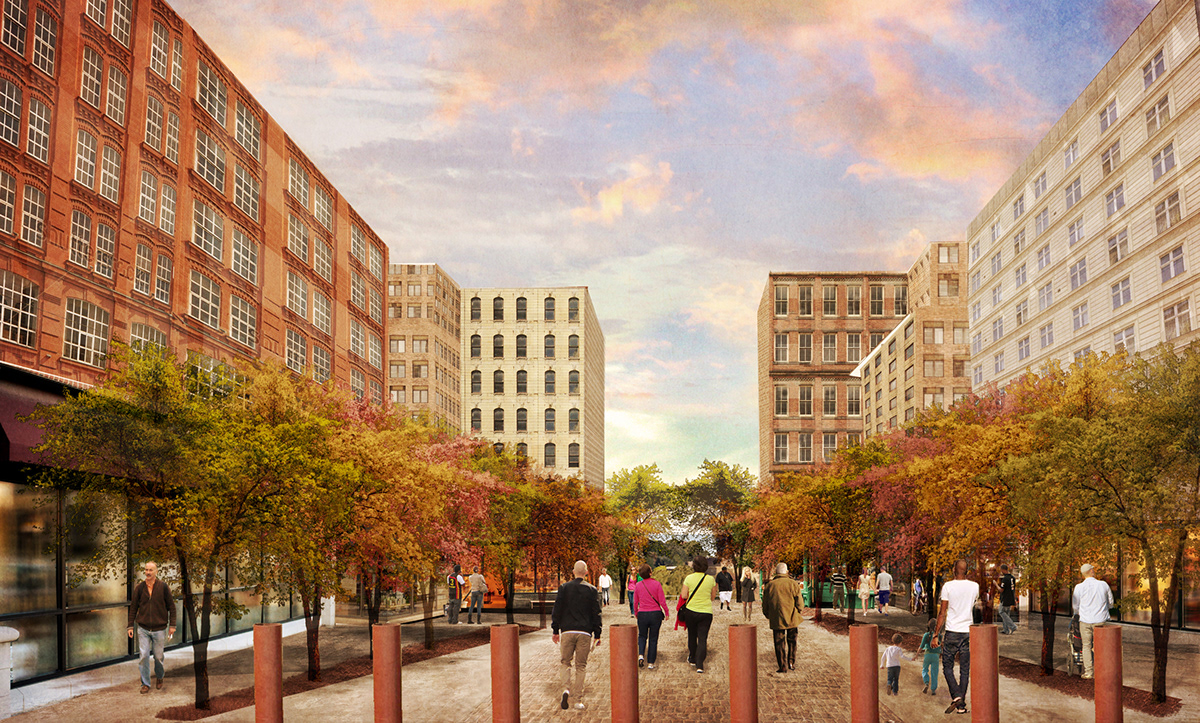
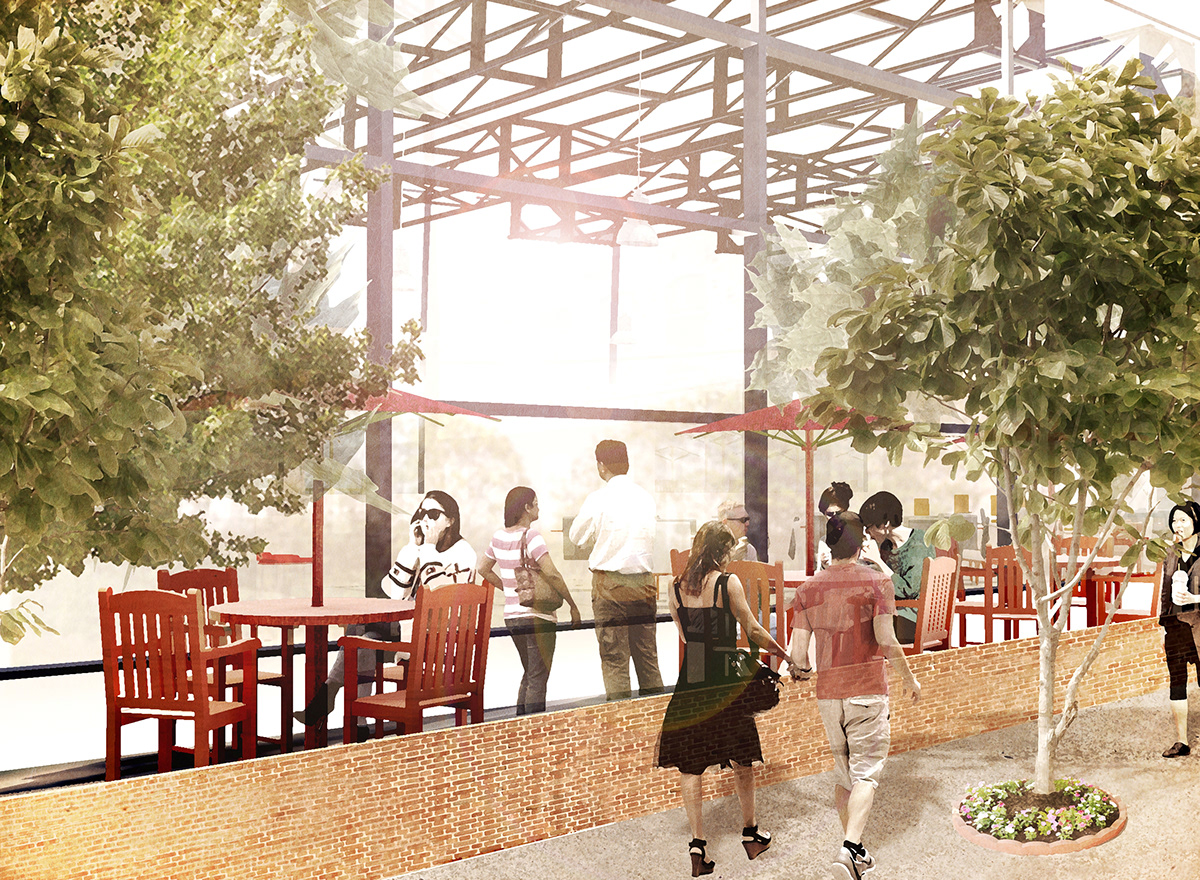
P E D E S T R I A N C O R R I D O R R E N D E R I N G
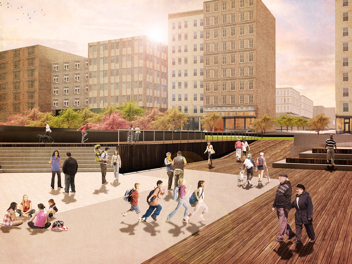
P E D E S T R I A N C O R R I D O R P I E R R E N D E R I N G
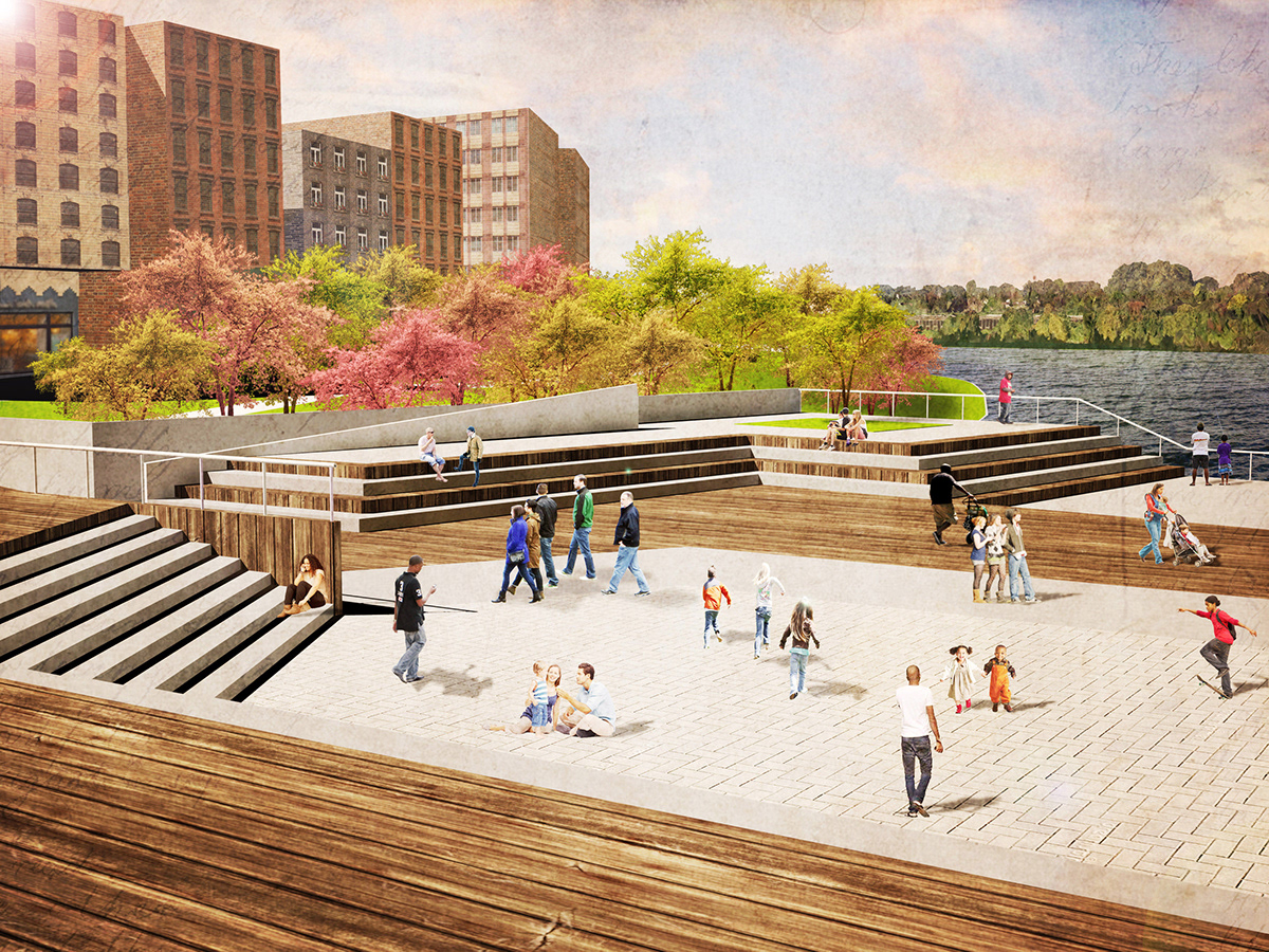
P E D E S T R I A N C O R R I D O R P I E R R E N D E R I N G A T W A T E R
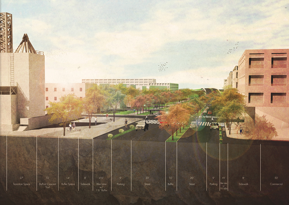
G R A Y S F E R R Y A V E N U E S E C T I O N
This section portrays the strategy to slow down traffic, create a pedestrian-friendly neighborhood and encourage plant growth.

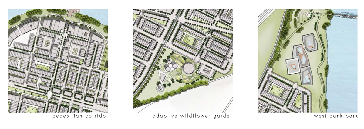
P E D E S T R I A N C O R R I D O R D I A G R A M
This typology diagram helps to showcase the levels of privacy and walkability created through proposed block layouts.

E A S T B A N K M I X E D - U S E T Y P O L O G Y
To create a neighborhood that encourages activity and engagement at all times of the day a mixed-use block typology is proposed. This typology serves as the transition to the strictly residential zoned areas of the urban proposal. By utilizing retail along the first floor of perimeter housing units, it helps to encourage commerce but bring activity to the blocks which will create a safer environment.
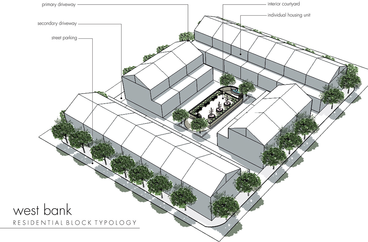
W E S T B A N K R E S I D E N T I A L T Y P O L O G Y
This diagram showcases the layout of the residential-only block configurations. Parking and activity is directed to the inside to create a more connected and safe environment for residents. This interior courtyard space also helps to serve as the basis for different program pieces throughout each block (garden, dog park, small playground etc.) This type of typology helps to create a more dynamic and engaged community.


N A T I V E P L A N T U S A G E
Plant species that adapt well to dry climates (housing sectors) and salt water (river sectors) were researched and implemented into the urban planning design. Keeping a natural and native feel to the area will encourage outdoor activity and bring an awareness to the natural world and the site's original historical roots.
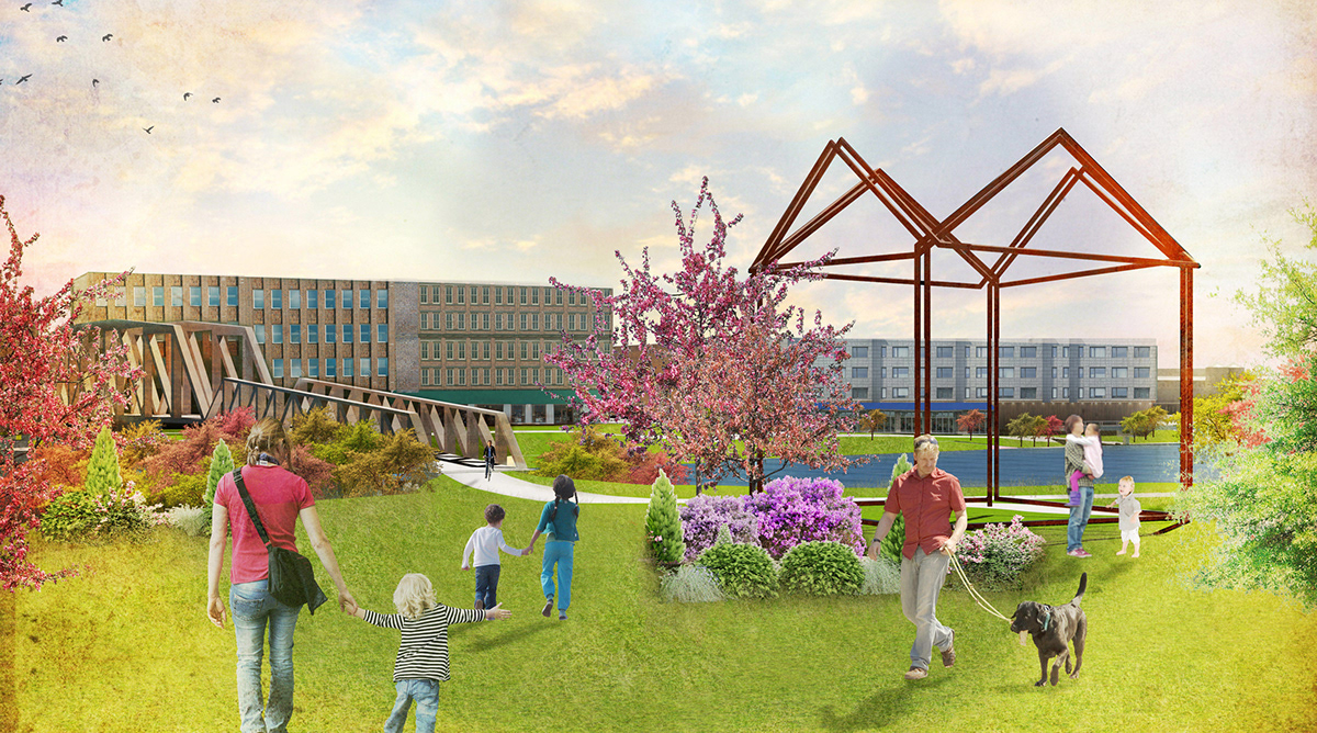
W E S T B A N K I N N P A R K R E N D E R I N G
In order to relate to the history of the site, a monument/sculpture was created to pay tribute to the Inn that was situated on the direct opposite side of the Gray's Ferry Ave bridge. This Inn served as a place of passage for those crossing the original swing bridge and before that, Gray's Ferry. The Inn has since been destroyed due to re-grading and an oil processing site.
In order to connect with Bartram's Mile and create a dynamic and historical space, the clean-up and creation of
Gray's Inn Park has been proposed for this redevelopment plan.
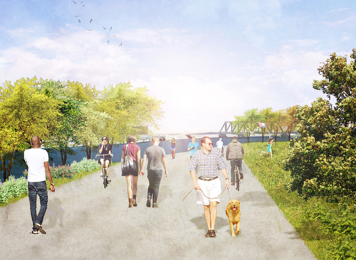
E A S T B A N K P A R K | G R A Y S I N N P A R K P A T H R E N D E R I N G
G R A Y ' S F E R R Y B R E W E R Y | S I T E I N T E R V E N T I O N
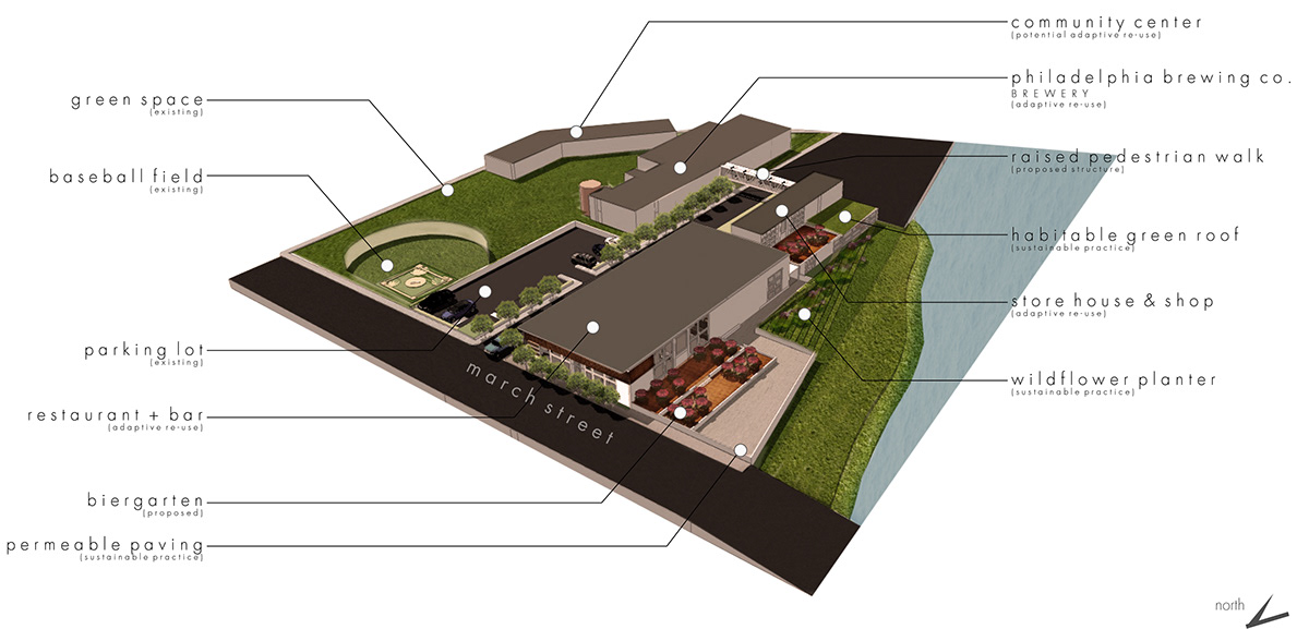
S I T E I N T E R V E N T I O N P L A N D I A G R A M
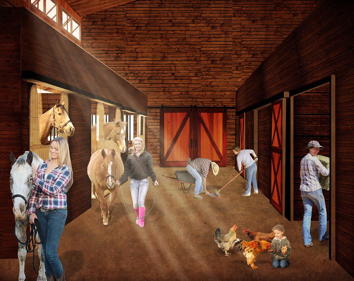
E Q U E S T R I A N C E N T E R | S I T E I N T E R V E N T I O N
In order to utilize the connection to Bartram's Mile & Bartram's Garden, an equestrian center is proposed for the western portion of the neighborhood development. This portion of the site is currently disconnected from the rest of the neighborhood and could serve as a key buffer and aesthetically pleasing site. The potential for riders to be able to board horses, take lessons and exercise them on the trails serves as a possible revenue generator as well as an attraction for the city. The equestrian center located in Fairmount Park has the potential to connect with this new program and forge a stronger connection from each end of the city.


W E S T B A N K B U T T E R F L Y G A R D E N & P L A Y G R O U N D I N T E R V E N T I O N
Along the western site exists a sector of land that has been used to house oil tanks. These large steel containers are currently empty and serve a unique opportunity to create a dynamic and re-use project. Since residential housing is the main typology on the western bank, a playground is ideal for families and visiting children to the area. The site utilizes the oil drums to create housings for porgram pieces throughout the intervention. The tanks create pieces such as a lighthouse and different bird oberservation platforms.
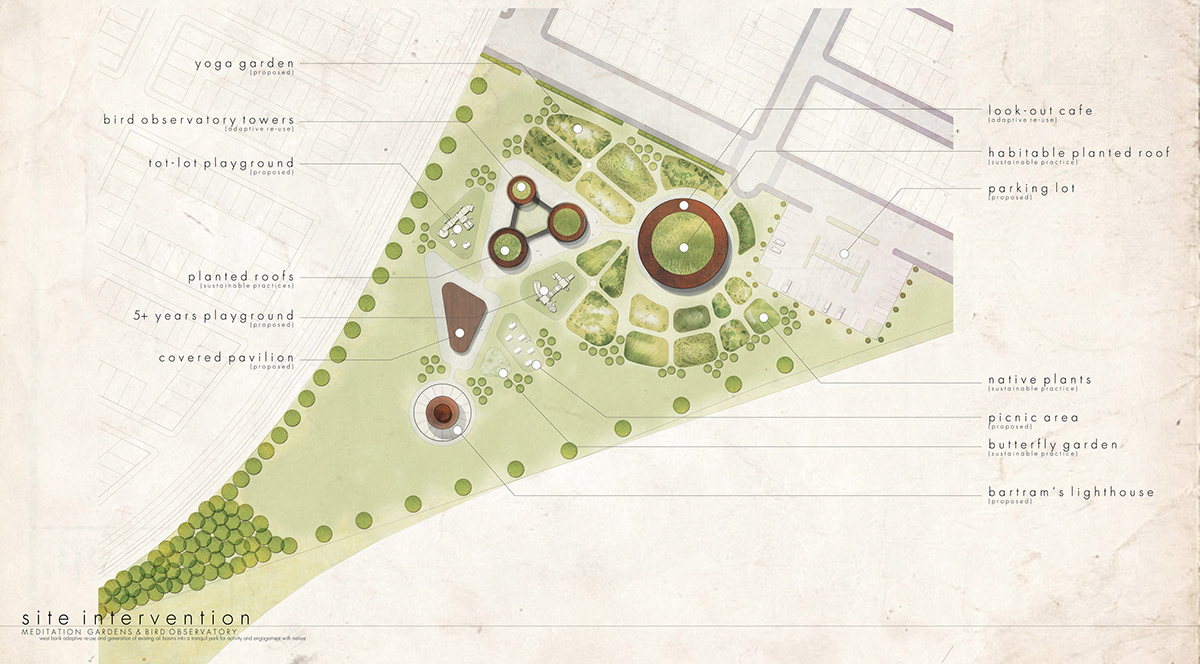
S I T E I N T E R V E N T I O N P L A N

A E R I A L R E N D E R I N G F A C I N G S O U T H

