
Map showing the % of hispanic population living in LA City
Client: Cynthia Gonzales, PhD applicant

Map showing Income distribution in Los Angeles
Client: Cynthia Gonzalez, PhD applicant.

Map created to evaluate hazard vulnerability in LA neighborhoods.
Client: Estolano LeSar Perez Advisors
Animated map showing the % of foreclosures in LA County year by year.
Client: Asian American Studies Center at UCLA

Map showing local identifying local businesses
Client: Council District 13 in Los Angeles

Map showing potential sites for pocket parks in Downtown Los Angeles, based in walkability and development potential.
Client: Self

Map showing available and underdeveloped land in Downtown Los Angeles .
Client: LA Planning Department
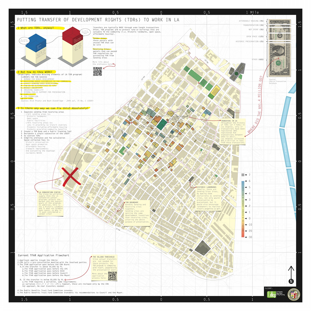
Map describing the TFAR ordinance in Los Angeles.
Client: Master in Urban and Regional Planning final project.

Map showing zoning distribution and transfer of air rights ordinance in Portland.
Client: Master in Urban and Regional Planning final project.

Map showing FAR regulations in Portland.
Client: Master in Urban and Regional Planning final project.

Map showing NYC Subdistricts
Client: Master in Urban and Regional Planning final project.
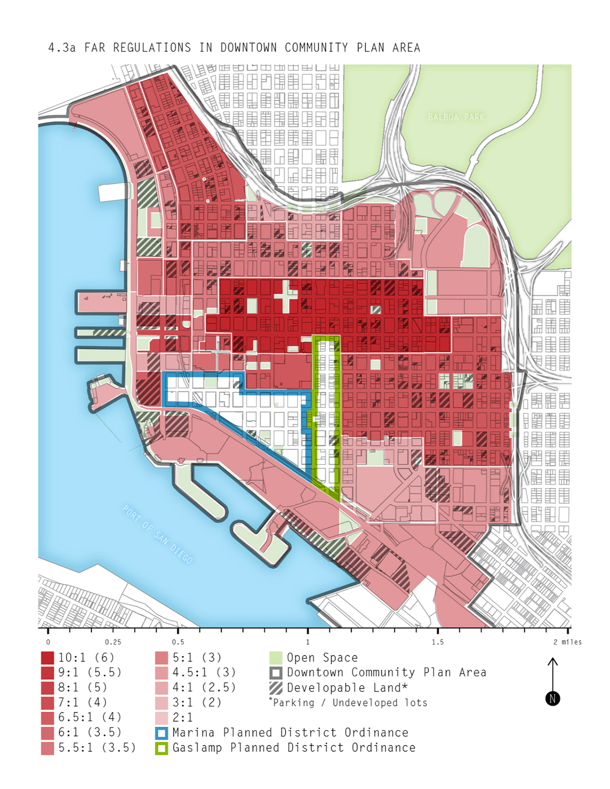
Map showing FAR regulations in San Diego, CA
Client: Master in Urban and Regional Planning final project.

Map showing the balace between historic landmarks, open space and parking lots in Downtown, Los Angeles.
Client: Master in Urban and Regional Planning final project.

Concept Map (Wireframe) of a website dedicated to serve as a search tool for developers, city officials, and the general public to track and analyze Air Right transactions in Los Angele's TFAR area.


