

The following work was completed in 2009 in the first year of my Masters Architecture degree at the University of Ulster.
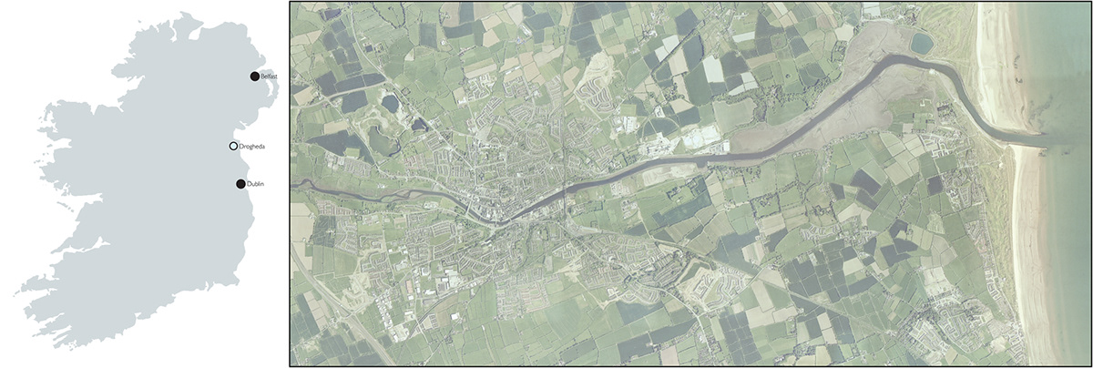
There is evidence that Drogheda and it’s hinterland has been settled for over 3000 years, but the current settlement dates from around 1000 years ago, when what is known now as St Mary’s Bridge was constructed. As the only bridge crossing the Boyne it created a vital link between the two largest settlements in Ireland, Belfast and Dublin.
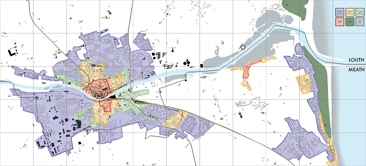
Due to it’s position in the river delta, it’s steep topography and the importance of the bridge, a walled city was established and named ‘Drochead Atha,’ or ‘River Crossing,’ which was then later anglicised to Drogheda. On the anlysis map belowI have highlighted the settlement areas and attempted to document how they grew over a period of 100 years. It is clear to see that the main settlement of Drogheda itself has radiated outward from this one crossing point in the river.
Due to it’s position in the river delta, it’s steep topography and the importance of the bridge, a walled city was established and named ‘Drochead Atha,’ or ‘River Crossing,’ which was then later anglicised to Drogheda. On the anlysis map belowI have highlighted the settlement areas and attempted to document how they grew over a period of 100 years. It is clear to see that the main settlement of Drogheda itself has radiated outward from this one crossing point in the river.
With Ireland’s population booming the need for new sites for housing is increasing exponentially. The current trend for strip housing developments, particularly around the outskirts of Drogheda, is threatening the unique character of the Irish countryside. In addition to this the ever-present menace of climate change is threatening the flora and fauna of the Boyne estuary’s floodplains. Action is required on both fronts.
I propose that environmentally minded individuals, families and businesses could form a series of communities located on the floodplains, dedicated to defending and preserving them while enjoying the benefits living in such an environment has to offer.These settlemensts will also act as educational hubs, informing locals and tourists alike about climate change, showing how the phenomena is affecting the floodplain.
I propose that environmentally minded individuals, families and businesses could form a series of communities located on the floodplains, dedicated to defending and preserving them while enjoying the benefits living in such an environment has to offer.These settlemensts will also act as educational hubs, informing locals and tourists alike about climate change, showing how the phenomena is affecting the floodplain.

I propose to place these communities in proximity to the existing small suburban settlements located along the Boyne, in some way justifying their existence and ratifying their remoteness and isolation, hopefully halting their sprawl along the banks of the river. This also limits the potential pollution from developments and housing along the river.
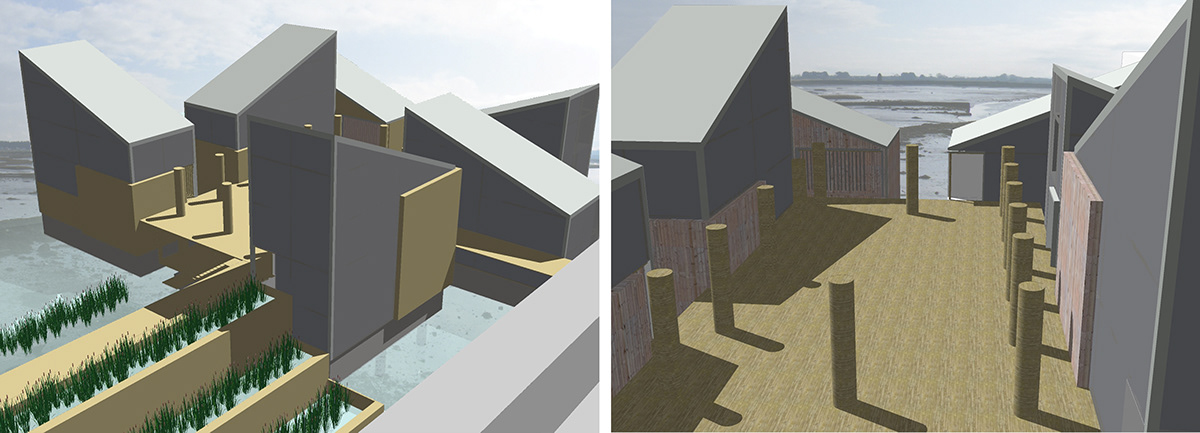
To preserve the delicate biodiversity of the floodplain from the seemingly inevitable effect of climate change direct action will be needed. I propose that a series of flora substrate propagation depots be placed around the floodplain. These depots will grow native algae, moss and wetland plants in controlled greenhouse conditions before transferring them to external wetland ‘gardens,’ allowing them to acclimatize to local conditions. This vegetation will then be transplanted into the floodplain itself, strengthening the existing foliage, protecting the banks from inundation and extreme weather (both of which may become more prevalent as the effects of climate change take hold). In addition to this, the old earth bermed causeways will be reinstated, which will allow the ebb and flow of the river water while further protecting the wetlands.
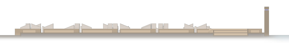
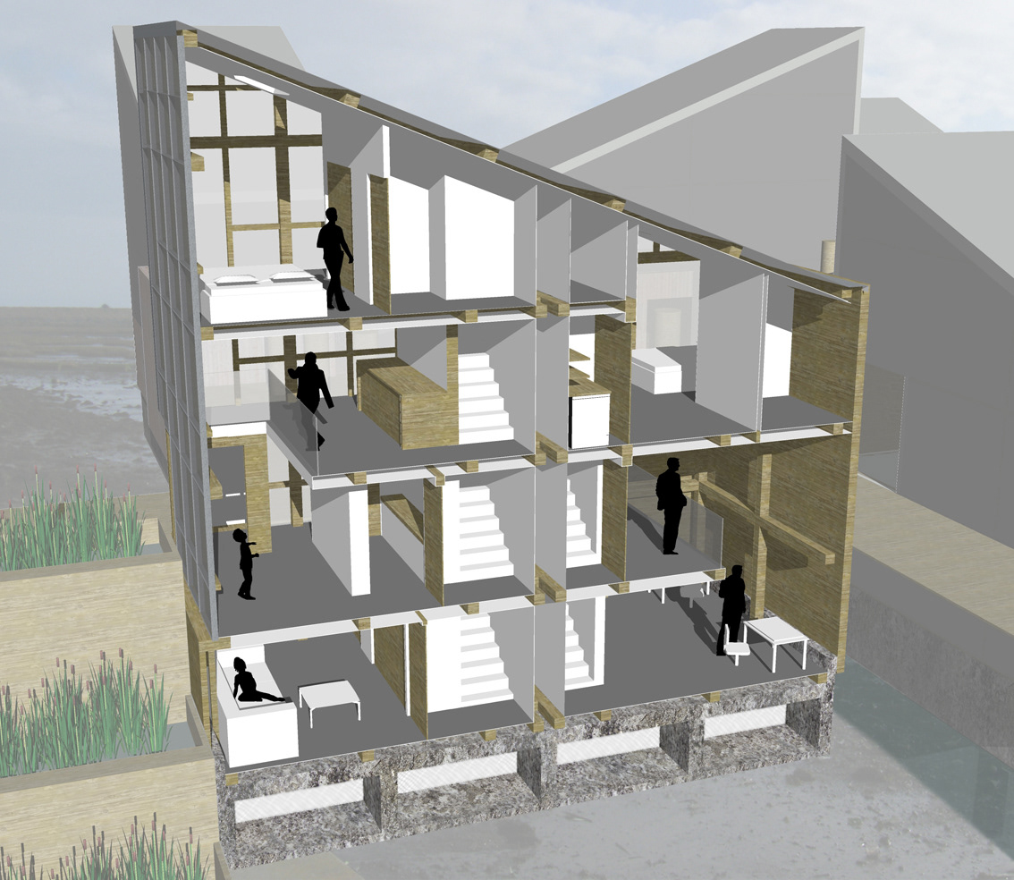
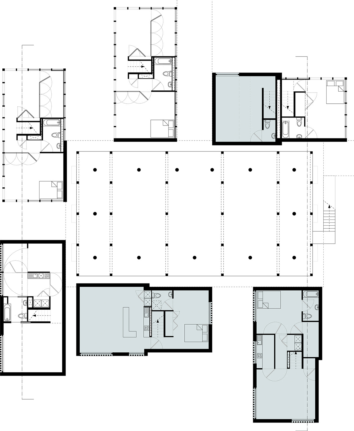
Arranged around these greenhouses and gardens will then be a series of living units, which will respectfully float above the floodplain, while still allowing access onto it. These housing components will include family units, apartments and live/work facilities complete with studio/office space.
To preserve the delicate biodiversity of the floodplain from the seemingly inevitable effect of climate change direct action will be needed. I propose that a series of flora substrate propagation depots be placed around the floodplain. These depots will grow native algae, moss and wetland plants in controlled greenhouse conditions before transferring them to external wetland ‘gardens,’ allowing them to acclimatize to local conditions. This vegetation will then be transplanted into the floodplain itself, strengthening the existing foliage, protecting the banks from inundation and extreme weather (both of which may become more prevalent as the effects of climate change take hold). In addition to this, the old earth bermed causeways will be reinstated, which will allow the ebb and flow of the river water while further protecting the wetlands.
Arranged around these greenhouses and gardens will then be a series of living units, which will respectfully float above the floodplain, while still allowing access onto it. These housing components will include family units, apartments and live/work facilities complete with studio/office space.
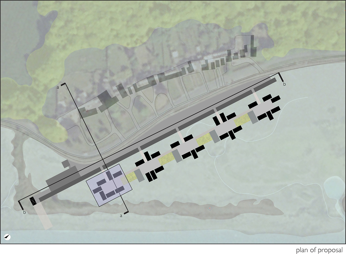
To decide upon the position of each propagation depot and it’s corresponding settlement I looked at the existing settlements situated along the northern Baltray Road and the southern Mornington Road. These will then be linked by ferry terminals located on the now reinstated causeways.
While well served by roads, the north and the south banks are both very much alienated from each other, with the last bridge over the Boyne situated in central Drogheda. Since the Boyne is a major shipping lane there cannot therefore be any bridges between the river mouth and Tom Roe’s Point (the new location of Drogheda Port). Therefore, a ferry system could operate on the river, increasing the connection between Drogheda, Baltray and Morninton/Bettystown/ Laytown and the new and potentially disparate floodplain communities.
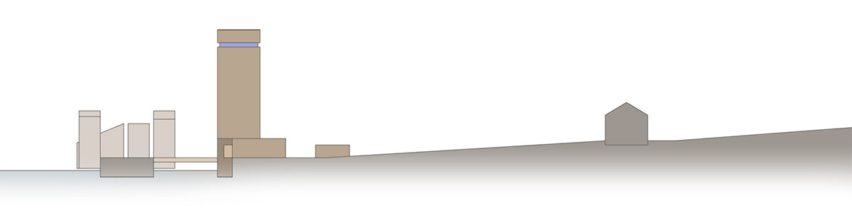
These ferry terminals will be marked with a tall ‘beacon,’ mimicking the language of the old beacons situated along the river. These highly visible markers will not only be visible locations along the river, but visible locations along the road, making the developments destinations
While well served by roads, the north and the south banks are both very much alienated from each other, with the last bridge over the Boyne situated in central Drogheda. Since the Boyne is a major shipping lane there cannot therefore be any bridges between the river mouth and Tom Roe’s Point (the new location of Drogheda Port). Therefore, a ferry system could operate on the river, increasing the connection between Drogheda, Baltray and Morninton/Bettystown/ Laytown and the new and potentially disparate floodplain communities.
These ferry terminals will be marked with a tall ‘beacon,’ mimicking the language of the old beacons situated along the river. These highly visible markers will not only be visible locations along the river, but visible locations along the road, making the developments destinations
Section A-A
Section B-B
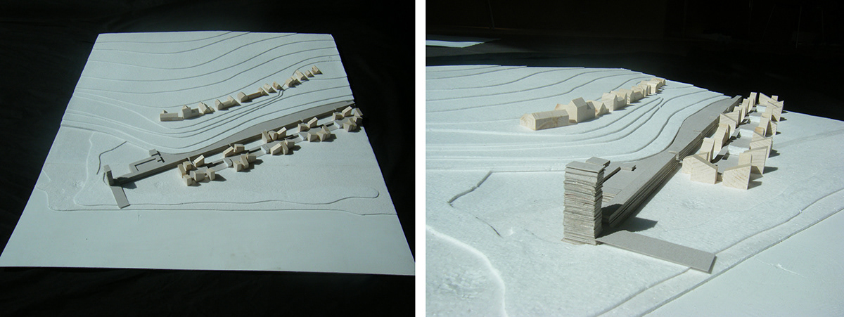
1.500 Context Model
Plan -1

Plan +0
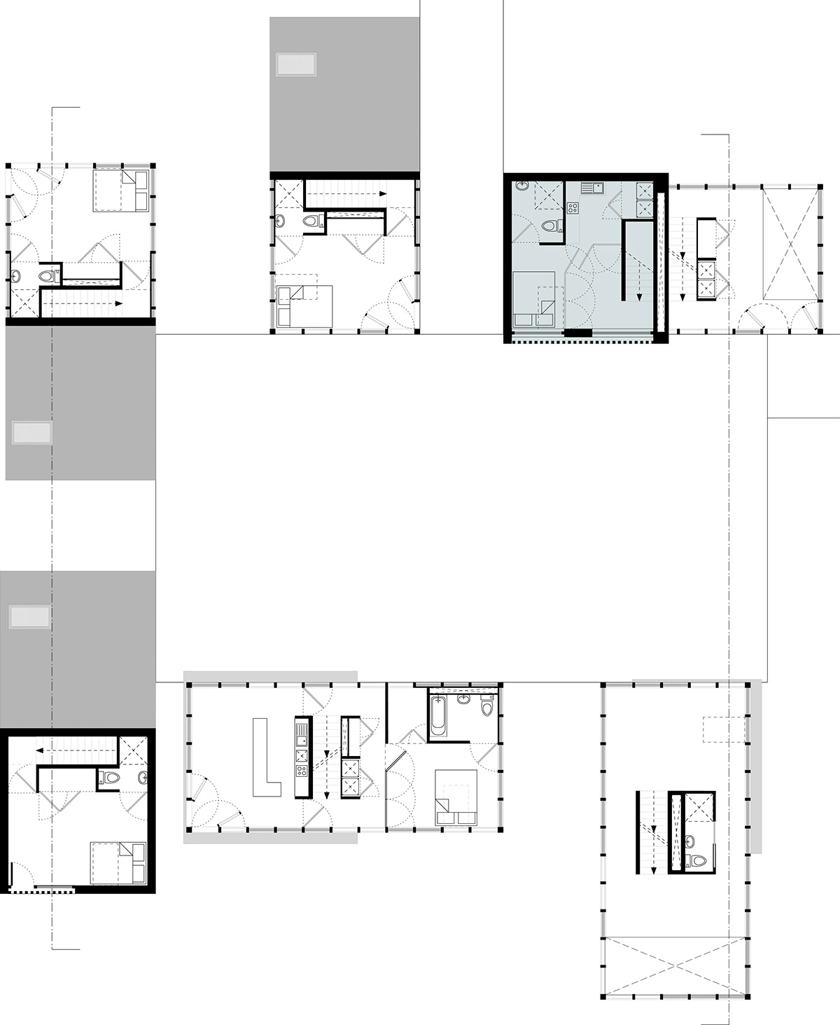
Plan +1
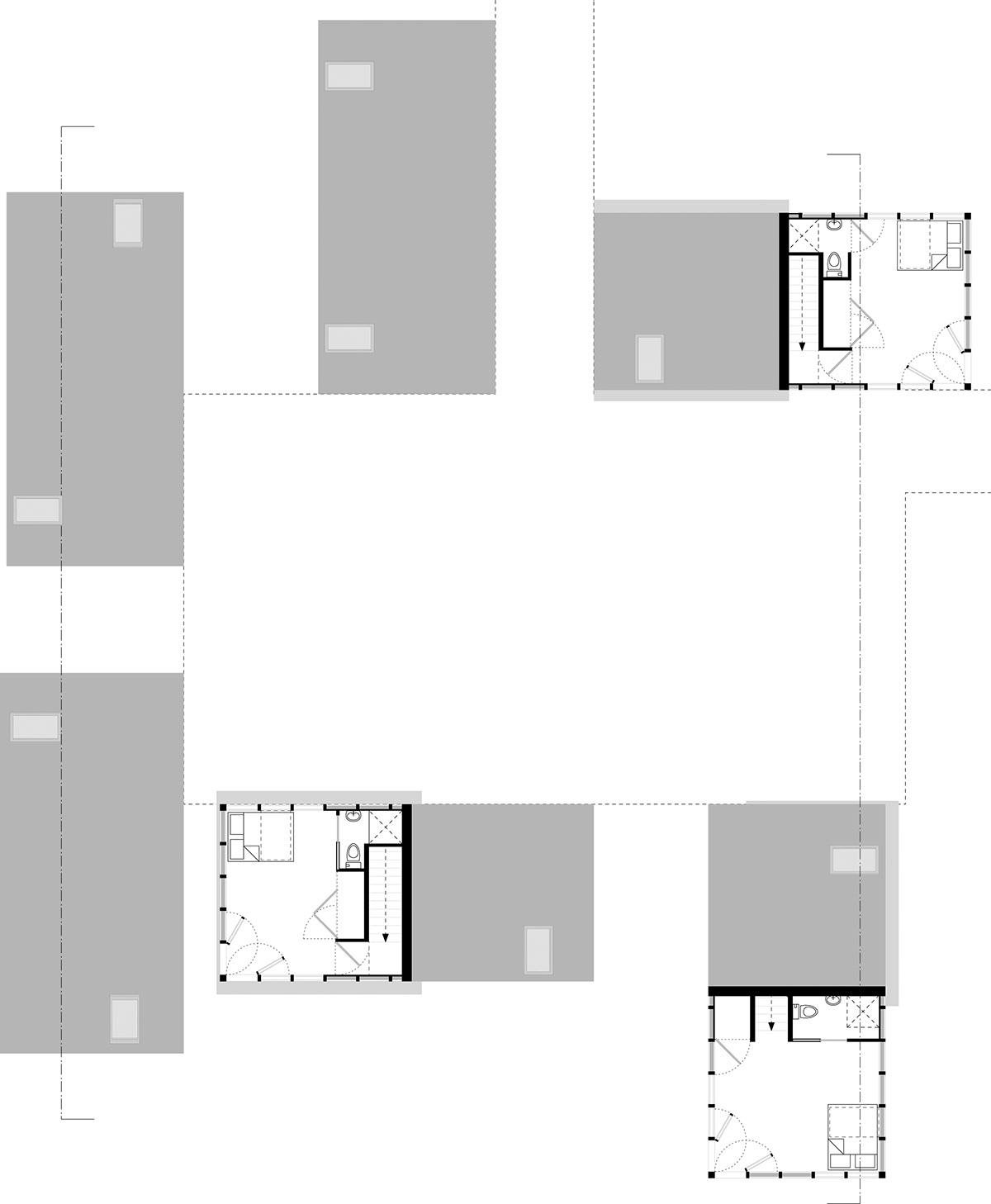
Plan +2


