

European city plans with 3D shaded relief
With this project we give new life to the old topographic maps of cities, restoring them thoroughly and enriching them with lidar and dsm data.
Encouraging a comparison between past and present and evocative visions.
Encouraging a comparison between past and present and evocative visions.
If you like our work, want to see our daily work or want to say hello to us,
Otherwise if you are interested in our prints or have a custom request check our shop vizcart.io
For inqueries or commission, feel free to contact us at hello@vizart.io


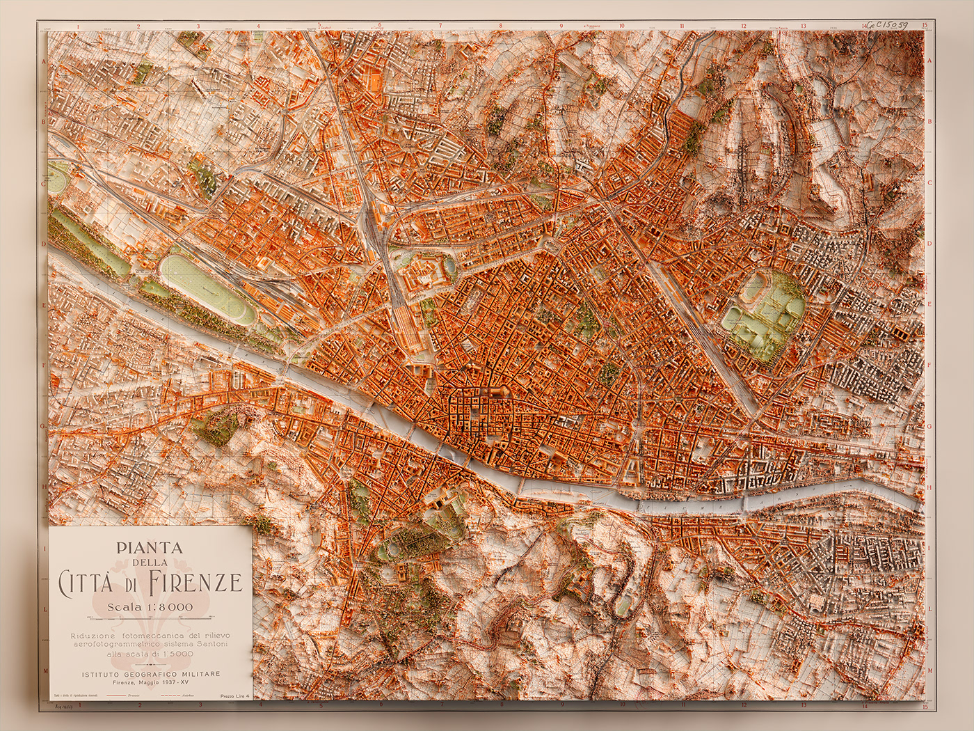
Map info: Pianta della città di Firenze, 1936. Istituto geografico militare, maggio (Firenze).
Source: BnF Gallica
Source: BnF Gallica


Town plan of Naples, Army Map Service. 1943.
Source: Princeton Education Library
Source: Princeton Education Library


Map info: Plano nuevo de Madrid / lo publica el acreditado anuario Noticiero-Guia de Madrid, la guía mas moderna y completa de Madrid, que se publica todos los años, dirigida por D. Vicente de Castro Lés, 1940.
Source: Institut Cartogràfic i Geològic de Catalunya
Source: Institut Cartogràfic i Geològic de Catalunya


Map Info: Plano de la ciudad de Barcelona / Ajuntament de Barcelona. Servicio del Plano de la Ciudad, Ajuntament de Barcelona. Servicio del Plano de la Ciudad,1962.
Source: Institut Cartogràfic i Geològic de Catalunya
Source: Institut Cartogràfic i Geològic de Catalunya


Map info: Amsterdam, metropolitan Area. Henry J. Bruman Map Collection, ~1914.
Source: UCLA
Source: UCLA


Map info: Rotterdam, metropolitan Area. Henry J. Bruman Map Collection, 1944.
Source: UCLA
Source: UCLA


Map info: Kristiania amt nr 77: Kart over Kristiania.
Amtskartsamling, Oslo 1901.Norsk Lithgr. officin, Oppmaalingsvæsenet i Kristiania
Source: kartverket
Amtskartsamling, Oslo 1901.Norsk Lithgr. officin, Oppmaalingsvæsenet i Kristiania
Source: kartverket