Experiments in Spatial Mapping
Student Commute Data
Student Commute Data
How do you get to your house from your current location? If you were already at home I suppose this exercise wouldn’t be too difficult… But how do you visualize your daily commute?
For me it is a display, in an almost instantaneous flash, of where I am in relation to where I need to go. Or vise versa. I’m not really a “Point A” to “Point B” thinker. I constantly visualize in abstractions of form in order to make sense of the space I inhabit.
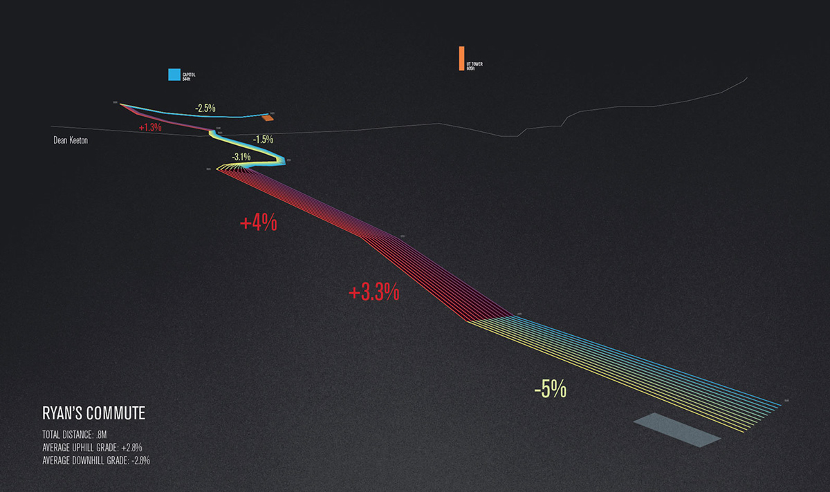
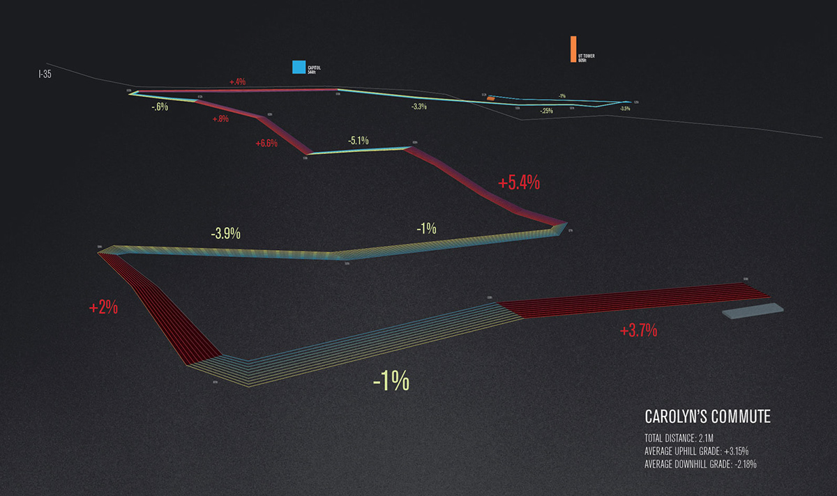
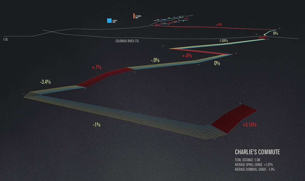
These are a few mapping exercises visualizing a commute from start to finish using an abstracted path to signify the relationship between both points. The hill grade may not be all that useful to those traveling by car, but these were designed with the cyclist in mind.
Reference data was acquired with GoogleEarth by exaggerated the terrain scale.
For me it is a display, in an almost instantaneous flash, of where I am in relation to where I need to go. Or vise versa. I’m not really a “Point A” to “Point B” thinker. I constantly visualize in abstractions of form in order to make sense of the space I inhabit.
These are a few mapping exercises visualizing a commute from start to finish using an abstracted path to signify the relationship between both points. The hill grade may not be all that useful to those traveling by car, but these were designed with the cyclist in mind.
Reference data was acquired with GoogleEarth by exaggerated the terrain scale.